Mine Reclamation
At its core, reclamation is an effort to restore harm done to a mined land’s soil health and prepare the land for another use after mining activities cease. Reclamation is ideally a two-part process undertaken from the moment mining activity begins: first minimizing negative environmental effects during mining and, at its conclusion, restoring land to a beneficial end use, such as open land, wildlife habitat, agriculture, residential/commercial use, etc. From a technical perspective, reclamation activities likely include efforts to “clean-up” the damaged landscape such as acid rock drainage management, efforts to control erosion and sedimentation, construction of tailings covers, revegetation, soil decontamination and topsoil replacement, and water treatment. While these technical aspects are needed, there is some research suggesting a more holistic, inclusive approach which aims to reframe reclamation as an “ongoing, creative process of community healing” emphasizing public participation and environmental justice concerns (Rethinking remediation).
This wiki serves to collect projects, methods, research, and questions related to mine reclamation. Help this resource grow by editing this page here! Visit the mine reclamation tag page to see the latest posts about this topic on Public Lab, and receive updates by following the #mine-reclamation tag:
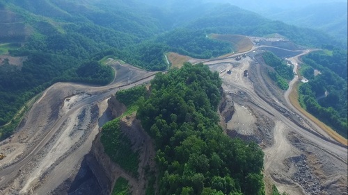
Lead image: "Reclaimed Mine Area_DSC_0168" by Intermountain Region US Forest Service is marked with CC PDM 1.0.
- Community stories and projects
- Questions about mine reclamation
- Methods and activities on monitoring reclamation
- Regulations on mine reclamation
- Advocacy
- Environmental and human health concerns related to mine reclamation efforts
- Further reading and resources
- Next step challenges
Community stories and projects
Public Lab community projects related to mine reclamation will appear here
More stories related to mine reclamation
- “Citizen scientists uncover water quality violations in Kentucky national forest” from Appalachian Voices.
- “The Indigenous Exchange Forum: transitions in mine closure” was a convening and report that “aim[ed] to facilitate knowledge exchange and to share innovative ideas and practices in response to mine site transitions between the First Nations groups, and between First Nations groups and industry.”
Questions about mine reclamation
Questions tagged with question:mine-reclamation will appear here
| Title | Author | Updated | Likes | Comments |
|---|---|---|---|---|
| What are observable signs of improper reclamation practices at or around mining sites? | @bhamster | over 3 years ago | 0 | 2 |
| What are plausible uses for reclaimed mining land? | @laurel_mire | over 3 years ago | 0 | 1 |
| How do I find the reclamation permit for an active mine? | @bhamster | over 3 years ago | 0 | 1 |
| What pieces of information and what level of detail should communities look for in a mining land reclamation plan? | @laurel_mire | over 3 years ago | 0 | 0 |
| Is there federal-level recourse that communities can take when mine reclamation is not being done properly? | @bhamster | over 3 years ago | 1 | 1 |
| Enforcement on inactive permits? | @ekpeterman | almost 4 years ago | 1 | 3 |
Methods and activities on monitoring reclamation
Photo documentation
Kinds of data produced: Visual records of observable reclamation permit violations / compliance, or reclamation progress.
Examples of permit violations are explained in these posts:
METHODS:
Aerial photography and videography
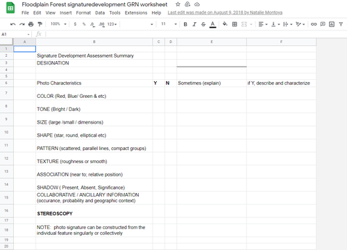
Signature Development for Aerial Photo Classification: Louisiana Wetland Forest Mine Reclamation project
Post by @eustatic 14 | over 3 years ago
Photography combined with Normalized Difference Vegetation Index (NDVI) to monitor plant growth over time on reclaimed land
- NDVI and NRG wiki page: contains information on what the NDVI is, questions other community members have asked about NDVI, and activities on using this indicator of plant health.
- This paper is an example of using NDVI analysis to assess plant growth following reclamation: Abaidoo C.A., Osei Jr. E.M., Arko-Adjei A., and Prah B.E.K. 2019. Monitoring the Extent of Reclamation of Small Scale Mining Areas Using Artificial Neural Networks. Heliyon, 5(4): E01445.
Reviewing public records to detect violations
Kinds of data produced: Possible reporting violations by mine operators: missing or unexpected data, repeated limit violations. These can be reported to a state agency (source: Appalachian Water Watch Citizen Monitoring Manual)
METHODS:
Reviewing Discharge Monitoring Reports (DMRs)
- “Reviewing Discharge Monitoring Reports And Permits,” starting on pg. 7 of the Appalachian Water Watch Citizen Monitoring Manual by the Appalachian Citizens Enforcement Project. This section outlines how to obtain Discharge Monitoring Reports (DMRs) and what to look for that might indicate permit violations. The whole guide is an excellent resource!
Water quality testing
Image: “Acid mine drainage from the Mike Horse Mine complex enters upper Blackfoot River watershed,” Earthworks, CC BY.
Kinds of data produced: Measurements of water pH, conductivity, and other parameters. Discharge and runoff from active mining can negatively impact these water quality indicators, while reclamation activities might improve them.
Water quality data that you collect can potentially be compared with data reported on Discharge Monitoring Reports (source: Appalachian Water Watch Citizen Monitoring Manual), and compared with relevant regulatory standards.
METHODS:
Identifying sites for water quality testing
- Guidance on how to use Google topographic maps to help choose a site for water quality testing around coal mines is outlined in Ch. 3, “Taking Action: How to identify hot spots,” in the Appalachian Water Watch Citizen Monitoring Manual
Measuring water pH
pH values indicate how acidic (low pH) or alkaline (high pH) the water is. The US EPA sets its freshwater pH standard between 6.5 and 9. Drainage from mines can be acidic or alkaline depending on what minerals the water interacts with as it flows through the mining site.
Note that one study in a Mid-Appalachian watershed found that while other water quality indicators improved after reclamation, pH did not:
“...acid mine drainage was still the dominant factor leading to the overall poor water quality (low pH, high sulfate and metals) in the watershed after reclamation was completed more than 20 years ago.” Wei et al. 2010
Measuring water conductivity
Water that has more inorganic solids dissolved in it (like salts, metals, or other chemical pollutants) generally conducts an electrical current better---it has a higher conductivity. Water downstream of mining activity could occasionally have higher conductivity due to dissolved solids from discharges.
- Methods for monitoring conductivity documented on Public Lab: https://publiclab.org/methods#conductivity
- More about conductivity is on pg. 16 of the Appalachian Water Watch Citizen Monitoring Manual
Monitoring soil health
Kinds of data produced: Measurements of soil pH, heavy metal concentrations, activity of microbial and other biological life, other indicators of soil health. Similar to impacts on water quality, mining activity and reclamation can affect these soil health indicators.
METHODS:
The soil contamination wiki at https://publiclab.org/wiki/soil is where we’ve collected and organized information on soil contaminants and testing methods. Below are some resources that might be particularly useful in monitoring or evaluating mine reclamation.
Activities
Activities tagged with activity:mine-reclamation will appear here
| Title | Author | Updated | Likes | Comments |
|---|---|---|---|---|
| Finding reclamation plans and permits for mines | @bhamster | over 3 years ago | 0 | 1 |
Activities should include a materials list, costs and a step-by-step guide to construction with photos. Learn what makes a good activity here.
Regulations on mine reclamation
US regulations
Different federal agencies are involved in regulating mining activity and reclamation in the US
- The Office of Surface Mining Reclamation and Enforcement (OSMRE) regulates coal mining and regulation in the US, operating under the 1977 Surface Mining Control and Reclamation Act (SMCRA).
- Other agencies that regulate mining activities in some way include the Bureau of Land Management, US Forest Service, and the Environmental Protection Agency.
- Federal laws that can apply to mining and reclamation activities include the Clean Air Act (CAA), Clean Water Act (CWA), Resource Conservation and Recovery Act (RCRA), and the Comprehensive Environmental Response, Compensation, and Liability Act (CERCLA) / Superfund.
- In many cases, regulatory activities are delegated to individual states or tribes. List of state mining agencies in the US.
For examples of how community science can engage with regulatory processes in mining and reclamation, see these posts from the Mountains and the Mines Monitoring Project team @ekpeterman, @jfreemanfilm, @junior_walk1337:
Abandoned mines
Many mines and surrounding lands that have since been abandoned by mine operators remain inadequately reclaimed. The Bureau of Land Management estimates that there are 100,000 to 500,000 abandoned mines in the western US alone, the location of most unrecorded. This poses massive public health, safety, and environmental hazards (publication about abandoned mine safety in CA). Tailings piles likely contain harmful chemicals which may leach into the soil, groundwater, and surrounding surface water, especially when left unmanaged at an abandoned site (source).
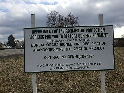
The OSMRE runs the Abandoned Mine Land (AML) program to help fund state- and tribe-led reclamation of abandoned coal mines. The Department of the Interior recently extended this program through 2034 (source).
Advocacy
Communicating expectations from Chippewa County residents concerned with frac sand mines
Post by @bhamster 1 | over 3 years ago
- Coal River Mountain Watch resources: specific to the state of West Virginia, this is an extensive list of resources for community members including a guide to citizen enforcement options, how to file complaints with relevant WV and federal agencies, and much more.
- Citizens Guide To Coal Mining and Reclamation in Indiana: specific to the state of Indiana in the US but provides useful information on opportunities for public participation.
Environmental & Health Concerns
There are numerous environmental concerns related to the mine reclamation process and abandoned mines, including:
- Sustaining plant vitality
- Soil degradation
- Soil erosion
- Invasive species
- Groundwater seepage
- Mobilized heavy metals
- Loss of carbon sequestration
The above environmental problems also lead to numerous human health concerns and things to be on the look out for:
- Heavy metal leaching
- Groundwater and surface water quality (especially if local drinking water uses these resources)
- Flocculating agents used in mining and reclamation process
Further reading and resources
- Coal mine reclamation from the Global Energy Monitor wiki
- Beckett C. and Keeling A. 2018. Rethinking remediation: Mine reclamation, environmental justice, and relations of care. Local Environment, 24:3, 216-230. PDF here.
- Kuter, N., 2013, 'Reclamation of Degraded Landscapes due to Opencast Mining', in M. Özyavuz (ed.), Advances in Landscape Architecture, IntechOpen, London. 10.5772/55796.
- Wei X, Wei H, Viadero RC Jr. 2010. Post-reclamation water quality trend in a Mid-Appalachian watershed of abandoned mine lands. Sci Total Environ, 409(5):941-8.
Wikis related to mine reclamation
| Title | Updated | Version | Views | Likes | |
|---|---|---|---|---|---|
| Mine Reclamation | about 3 years ago by laurel_mire | 15 | 421 | 0 | |
| Evaluating the Success of Mine Reclamation | over 3 years ago by laurel_mire | 31 | 620 | 0 | |
| Observable water quality violations related to frac sand mining | about 6 years ago by stevie | 8 | 306 | 1 | |
| Frac Sand Advocacy Leverage Points | about 7 years ago by stevie | 35 | 730 | 0 | |
| Building a Frac Sand Economic Assessment | about 8 years ago by gretchengehrke | 5 | 491 | 1 | |
| Butte, Montana: Centerville Neighborhood | about 14 years ago by Olivia | 1 | 330 | 2 |
Next step challenges
Areas for potential further development in tools, resources, and advocacy. Please edit or add to this section so folx can see where they might be able to contribute!
- Identify advocacy pathways that include federal regulations or enforcement, especially when state regulations result in inadequate reclamation.
- Develop and test methods for community scientists to use landsat imagery (satellite images of Earth from space) to do remote monitoring of surface mining and reclamation over time (example here).
- Research and develop sensor networks for monitoring soil and water quality around mining sites, to detect potential pollution in real-time (similar example for agricultural applications).
