Balloon/Kite Mapping
Public Laboratory Map Toolkit
aerial photography and map making with balloons, kites, or some other platform for flying a camera.
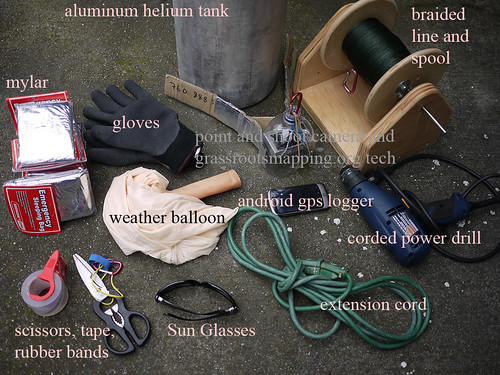
1 flight platform: Public Laboratory Balloon Mapping Kit reusable chloroprene helium balloon, hoop winder, braided kite line http://www.kickstarter.com/projects/1775485688/balloon-mapping-kits
2 camera house: PET Bottle & Rubber Band Rig wraps around the camera for protection while firmly mounting it in a position for vertical mapping images. http://publiclaboratory.org/wiki/pet-bottle-rubber-band-rig
3 camera that supports continuous shooting mode or video with a large storage card
4 map making software: Public Laboratory Map Knitter https://mapknitter.org
Purpose
This tool is being developed to provide a low cost, easy to use, and a safe method for making aerial image maps. Over the last two years, we’ve build a global community of mappers who are engaged in discussion around the development and use of these tools. Normally aerial image maps are made from satellites and airplanes. This activity introduces easy methods for making on-demand image maps. Our community is particularly interested in applying this to civic and environmental issues.
Applications and example uses
Residents of the Gulf Coast are using balloons and kites to produce their own aerial imagery of the Deepwater Horizon oil spill… documentation that will be essential for environmental and legal use in coming years. We believe in complete open access to spill imagery and are releasing all imagery from the oil spill mapping project into the public domain. Browse maps and data from the Gulf Coast in the Public Laboratory Archive
How to make your own
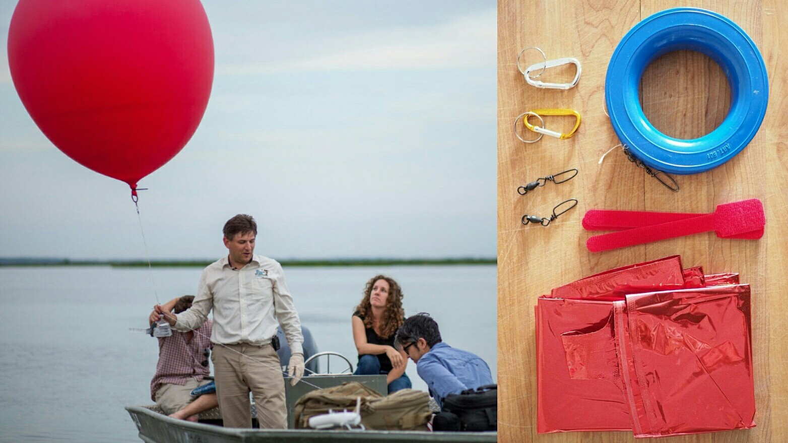
Assemble a balloon kit
Assembling a balloon kit should take you about 1 hour and cost between $100-200.

Download the 4-page illustrated guide to balloon and kite mapping - including a parts list and flying tips (other languages here)
Balloon Mapping Materials »
Read the above page for a full listing of materials and cost/performance comparisons. At minimum, you'll need:
- at least 1000 ft of string on a spool
- a cheap digital camera with "continuous mode"
- a balloon or kite
- a rubber band
- tape & scissors
- leather or cloth gloves
How to use it
Balloon mapping
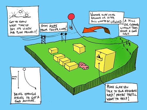
- The illustrated guide (above) includes lots of tips for a successful flight; print it and bring it with you!
- Be sure to review the Balloon Mapping Regulations for the US, or the equivalent wherever you are planning to map.
- Try to launch your balloon to at least 1000 ft for a good compromise of high resolution vs. large area
- Stay away from power lines, airports, and traffic
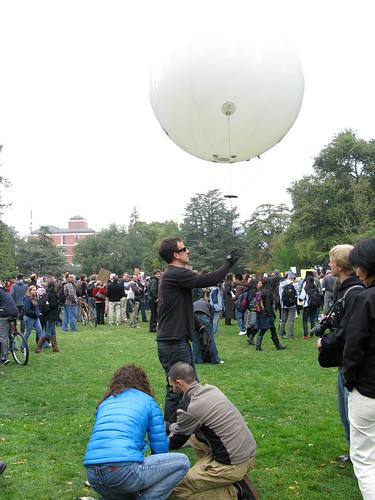
Kite mapping
- Kite mapping - A large kite photography community exists -- find online resources and a list of recommended kites.
Sorting and stitching images into maps
- Take the next steps: review the Upon Return page
- Contact the Public Laboratory team to get your images hosted on MapMill.org, and reach out to the Grassroots Mapping mailing list to get help sorting them.
- Use Map Knitter to stitch your photos together into maps online and export them in GIS formats
- Image Analysis - Try some of these techniques for bringing out detail and compositing your images with near-infrared imagery.
Advanced techniques
- Ground Control Point Targets can help you figure out how your images fit together if there are not good pre-existing maps for your site
- Infrared Balloon Mapping - Balloon mapping with a modified camera which takes infrared pictures. Good for identifying vegetation and its health.
- Hydrogen ballooning - don't try this yet, but we're looking into this for places where you can't get helium, or it's too expensive. [[balloon-mapping]]
Get involved!
- Do you have a site in mind which you'd like to map? Looking for collaborators or just need some tips and advice?
Next Steps
- Join the mailing list -- it's full of people all over the world who are offer advice and support
- Contact Public Laboratory staff directly
- Check out the community blog at http://grassrootsmapping.org/ When getting in touch, be sure to mention:
- the coordinates of the site
- context; what you'd like to use the data for
Short-term Goals
- Encourage more participants to engage in our community of DIY mappers
- Expanding the Public Laboratory Map Archive