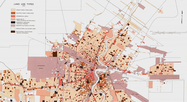
Image: Map of land uses in Winnipeg, Manitoba, Canada, from the 1970s. Wyman Laliberte, CC BY.
Purpose
This activity helps to get started with investigating your soil. Learning about past and current activities on and near your land can help identify pollutants that might be present. Having an idea of potential soil contaminants can then help you in planning for eventual soil testing, where narrowing down the list of possible contaminants will reduce testing costs. This activity breaks out and builds upon an early step identified in "Things to consider when testing soil for contaminants," by @DanielleS!
This first step of researching the site is recommended by several soil sampling guides (like this Statistics for Action Soil Quality Guide) and Public Lab community members. You might also see this research described as finding out the "land use history," but this activity also encourages researching current activities and industries on or near the site.
Materials needed
- A computer/tablet with a connection to the internet
- Access to public libraries or town archives for records that aren't online
- A way to record your findings: a list or even a map!
Steps
Here are some things you can do to get more information about your land:
1. Make observations on your land
This factsheet on Sources and Impacts of Contaminants in Soils from the Cornell Waste Management Institute has lots of great guiding questions in the section entitled, "What are Some Common Sources of Soil Contaminants?" Some examples:
- Were any buildings on the site built before the 1970s and therefore might have lead paint on the exterior?
- Are there old fences or decks built with pressure-treated wood that contain arsenic that could have travelled into nearby soil?
- Is there a high-traffic roadway nearby that could have contributed to lead in the soil when leaded gasoline was widely used?
2. Talk to other people in your neighborhood
Ask them about past and present residential or industrial activities nearby.
- Was a former resident readily applying pesticides in their garden? In the US Pacific Northwest, for example, many residential lots were formerly small orchards and could have pesticide residues in the soil.
- Was there a formerly-active cement factory nearby whose emissions could have landed as dust on your land?
3. Find publicly available land use records from local / municipal sources
- From your town or city hall or county
- Some cities allow you to access land parcel reports online, which often list the land use category (e.g., residential or a specific industry). You could review the report for the parcel containing your site and neighboring ones.
- For example, the city of Bellingham in WA, US, has an interactive online mapping tool called CityIQ that enables you to select an area on a map and see reports for parcels within that area. I selected a parcel on what I know to be an industrial waterfront area, and learned it's a Model Toxic Control Act site (a site containing hazardous substances).
Example land parcel report for a garbage collection and recycling service facility
- From local public libraries
- Another example from Bellingham, WA, where the local public library has compiled a list of resources for researching the history of your home and neighborhood. I found this by browsing the library website, but you could also call the library and talk to someone who could direct you to their resources.
4. Search regional and national databases
Examples from the US:
- Bureau of Land Management online record search
- Envirofacts search tool from the EPA: you can search multiple EPA databases at once by address or zip code. The search will produce a map and list of facilities that are regulated by the EPA and have to report to the agency. Click on any facility to view its report, which lists "Supplemental Environmental Interests" about hazardous waste or toxics.

Example list of environmental programs, permits, and notices on a facility report from Envirofacts
- You can also search EPA databases specific to "Land" by location or zip code, and find information on hazardous waste and clean up sites.
The Envirofacts homepage. Search via the search bar on the left or by topic. Land, Waste, and Toxics might be particularly useful in your land use research.
Wrap up
By the end of this activity, you hopefully have an idea of potential sources of contaminants in your soil and have recorded them down. Maybe you've already started to identify possible contaminants that could have come from these sources.
Follow up activities
- Research what contaminants are commonly associated with the land's past and current uses. This is Step 2 in "Things to consider when testing soil for contaminants"
- If you haven't already, try mapping these potential sources and any likely contaminants you've identified! You don't need a fancy map, something you draw or print out and draw on would work to help you keep track of potential pollutant sources and eventually develop a soil testing plan. Here are a couple mapping activities to try:
References and additional resources
- Cornell Waste Management Institute: Sources and Impacts of Contaminants in Soils: the resources list at the bottom of this factsheet contains more resources.
If you have any ideas or tips to add to this activity, please comment below!
3 Comments
cc @eymund would love your forensic geography insights on this
Great research tools !
Below are some additional checklist questions for community forensic geographers and CSI agents (Creek Scene Investigators)
Sites with these land use characteristics may often have contamination and other environmental issues:
- is your site low lying - eg where surface water would naturally flow to ? Historically valleys, stream beds and ponds acted as garbage dumps for first settlers. Even if valley site itself was filled with clean soil (eg. a chopped down local hill) the buried stream bed may still carry contaminants from, for example, the upstream now landfilled pond behind the demolished chemical factory.
- is your site within 1 block of a rail line? (which may no longer exist..) Check old maps like the Library of Congress online map library (https://www.loc.gov/collections/) and the David Rumsey map archives (https://www.davidrumsey.com/) for excellent libraries of historical maps. Historically, sites near rail were prone to all the industrial products and contaminant (spills) carried by rail.
- Is the site within 3 or 4 blocks of a shoreline ? To facilitate docking, natural edges were land filled with a wide range of materials. Shorelines include now gone canals (think Love Canal) and now invisible piped rivers.
- where are the oldest roads in your neighborhood ? The more history, the more potential issues for the lots adjacent to those roads.
- is your site crooked - or not square, or near an angled road ? Non gridded sites tend to pre colonial, with the longest history of human use (and pollution)
- Does your street have an unusual name ? Like Railroad, Depot, Pearl, Spring, Mill, Kill, or Fly (vlei) street for example .. often the land use history of a site is in plain sight on the street sign.
- How BIG are the buildings around your study area? Try color coding them by their square footage area, and you will often get the ghost of the underlying ecosystem. It turns out (in New York City) that buildings over 2000 square feet are typically built on landfilled marsh sites. This is is because when developers would split up newly acquired farm land, the well drained hillside areas became the smaller (typically less than a 1000 ft2) easy to sell residential lots. Farmer Brown's old mill pond (expensive to drain) would be where construction waste ended up. Such "waste land" would get inherited by industrial developers or the city who would make it a playground, school or public housing.
An example of forensic geography mapping for the Gowanus Canal Superfund Brouwers Mill Pond site in Brooklyn New York. Mapping is based on the 1766 Ratzer Survey Map and NYC DOITT building footprints. The stream mapping was refined using balloon vegetation mapping techniques with the Gowanus Canal Conservancy and the Dredgers Canoe Club.
Small buildings are at the edge of the marsh. Larger buildings are on the landfilled tide marsh. The actual pond and stream bed became city parks and parking lots.
By mapping the stream flows through the "Map of Nothing" empty spaces, we can better understand the flow directions of buried coal tar pollutants.
- Is there Nothing on the historical map ? You go through the old maps at the library, and you are disappointed that there are just blanks for your study area. Do not despair - get excited. Lack of data in this case is also information. Take a piece of tracing paper and start using a green marker to fill in all the white "vacant" spaces on the old map showing first buildings appearing in your study area. Sanborn maps are a good reference for this. (https://en.wikipedia.org/wiki/Sanborn_Maps)
You may start seeing appear patterns of the old marshes and stream beds .. these were often considered too unimportant to map. Start comparing your "Map of Nothing" to even earlier maps to see if there was actually a river or shoreline indentation there. Indentations are clues to stream outflows. Did the road take a weird bend or split right at the area you are interested in ? Why ? What were the "Nothing Spaces" subsequently filled with ? Where there contaminants in the landfill ?
- Are there the dead end roads on your Map of Nothing? Highlight them. Now look at the topography or contour lines near those road ends. United States Geological Survey 1:24000 maps are good for this. (https://en.wikipedia.org/wiki/Quadrangle_(geography))) Are there unusual piles of stuff where you wouldn't expect them to be in the normally flat former marshland area ? Unusual dirt piles in you backyard are often a clue to something funny going on.
Blame the dog - or the absence of the dog.
Gregory (Scotland Yard detective): "Is there any other point to which you would wish to draw my attention?"
Holmes: "To the curious incident of the dog in the night-time."
Gregory: "The dog did nothing in the night-time."
Holmes: "That was the curious incident."
(from The Adventures of Silver Blaze, Arthur Conan Doyle, 1892)
Sherlock Holmes on The dog that didn't bark - because it knew the murderer.
Absence is Presence. And the Invisible can be made Visible.
Happy forensic geography mapping !
Eymund
Is this a question? Click here to post it to the Questions page.
Reply to this comment...
Log in to comment
Also noting the amazing work of the Brown Superfund Research Program, which we helped to create the "Unearthing Providence" site here:
https://publiclab.org/unearthing-pvd
They have bulk-scanned municipal business records since the early 1950s for the entire state of Rhode Island and digitized and mapped all entries. There's a wealth of information on metalworking and other manufacturing activities for many many addresses. I believe they're hoping to repeat this for all 50 states, over time.
Is this a question? Click here to post it to the Questions page.
Reply to this comment...
Log in to comment
Login to comment.