Robby Gaude:
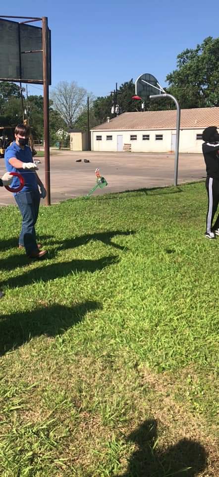
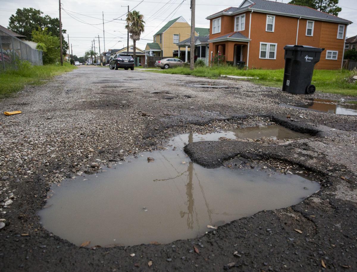
Recently, our class decided that we wanted to tackle an issue that affects our local community: potholes. Although balloon mapping is an effective method for observing potholes, we were unable to use this process due to a lack of helium; so we used a kite instead. We flew the kite three separate times with varying results, but all three launches and landings were successful due to the amount of wind and available personnel. We used a cheap point and shoot camera to take photos for our first flight, but we were not able to see the images clearly. We used an Arduino camera for the second flight. I mounted the camera and power bank onto a sheet of foam board, but we found that this design also had its flaws. The foam board caught a lot of wind and was very turbulent, which made nearly all the photos virtually unusable.
The final flight, however, was much more successful. We had changed the camera's housing by placing the camera inside the top half of a split two-liter bottle. By attaching a plastic tail on the back of the bottle half, we were able to prevent the camera from being so affected by the wind. Therefore, the camera remained facing down throughout the flight, and the pictures came out great. Next time I would like to use a helium balloon to take pictures, but our current kite-mapping has allowed us to get a good aerial view of our school and the surrounding area. This kite-mapping method could possibly allow us to spot potholes, but these flights taught us that we would need to take the pictures at a much lower altitude to get a detailed view of the road's surface. However, a potential downside of using multiple photos from a lower altitude still remains: it is very difficult to properly align the images and you will almost certainly have jagged edges where the images overlap. The process was a very enjoyable and beneficial experience overall; I am glad to have had the chance to collaborate with classmates and innovate potential solutions to our community's infrastructure problems.
Torron Brown:

When it came to the idea of what problem or topic we could discuss and research about, the one that immediately came to mind was potholes, since they are all over the state of Louisiana. When I thought about it, I instantly looked up as much information as possible and came up with questions about the topic to use in a survey. After analyzing the data from the 124 responses we collected, we reached the consensus that many people are aware that potholes are everywhere in the environment and that they can be very dangerous if left unattended. The first-time performing map knitting was exciting because it allowed us to be creative with how we gathered intel on the landscape around us. Out of the three flight attempts where we used the kite to gather images for the knitting process, the third one proved to be the most optimal process. It contained the most clear, concise, and vibrant images. We were able to observe a wider range of land than the other two flights. The whole experience did create some slight anxiety for us, since we were trying a lot of new techniques; but in the end we found it fun and interesting. The process allowed us to gain a different point of view, literally. We now have a better understanding of where there are high concentrations of potholes on our surrounding roads. In addition to camera variation, we were also able to test multiple altitudes to possibly have higher quality images.
Jeremiah Jackson:

When we were first asked "what is a good issue that impacts our surrounding area and provides opportunities for research?" many ideas came to mind. We considered everything from pollution railroads; but when someone mentioned potholes, we all recognized that it would be the best topic because of how many people it impacts. So we spent a lot of time researching the issue and surveying the community to better help understand how potholes affect the people of our city. The results from the map knitting we conducted and the surveys we gathered showed just how significantly potholes affect the community around us.
I really enjoyed the whole process of discussing and actually performing our balloon mapping experiment. This was my first chance to ever experience something like this. All our flights and landings were successful in terms of the effectiveness of the equipment, mostly due to the near perfect wind conditions. Eventually we were able to deploy the kite at high enough levels to get great pictures. In fact, the images were clear enough to better help us understand the environment around us from an aerial view. Although the project went well, there were a few things that ended up being a struggle. The process of bringing the kite back down was a pain, it caused a lot of stress & strain for just the four of us. Other than that I enjoyed this whole process and would definitely consider participating in similar projects in the future.
Links following this project:
https://publiclab.org/notes/Rgaude/03-26-2021/what-causes-potholes
https://publiclab.org/notes/Rgaude/04-07-2021/potholes-in-new-orleans
https://publiclab.org/notes/Rgaude/04-14-2021/potholes-in-new-orleans-research-note
https://publiclab.org/notes/Rgaude/04-30-2021/potholes-in-new-orleans-study-design
https://publiclab.org/notes/Rgaude/05-10-2021/potholes-in-new-orleans-balloon-mapping-experience
https://publiclab.org/notes/Rgaude/05-13-2021/potholes-in-new-orleans-annotated-map-update
https://publiclab.org/notes/Rgaude/05-14-2021/potholes-in-new-orleans-survey-results
https://publiclab.org/notes/Rgaude/05-14-2021/the-pothole-problem-a-new-orleans-pothole-project
0 Comments
Login to comment.