Open Water
Please consider donating to fund development of our water quality prototypes and workshops before our Feb 14th deadline!
How can you tell whether your local water is safe for drinking or swimming?
Public Lab is working to make water quality information accessible for communities everywhere. By designing a low-cost, ‘open source’ water quality monitoring platform that is easy to use, build, and maintain, we aim to enable communities to develop their own grassroots water quality monitoring networks, and to assess common threats to local water quality, like industrial pollution and coliform bacteria.
Our aim is to empower people with open source water quality tools, so that:
- local residents can track changes in their drinking water quality using sensors that they build and use themselves;
- a home-grown early warning system could warn swimmers of high bacteria counts in urban watersheds;
- students could serve as stewards of their local river ecosystem by evaluating the impacts of climate change;
- researchers, water resource managers, and citizen scientists can easily and accessibly share water quality data.
Our project currently has three main goals:
1. An open source water quality sensor
We're developing a low-cost, open source hardware device that will measure some of the most common water quality parameters , using a design that makes it possible for anyone to build, modify, and deploy water quality sensors in their own neighborhood.
Update! 1/14/14 -- PVC probe enclosure design:

Update! 1/25/14 -- First 3D printed enclosure design:

Update! 1/27/14 -- First successful deployment of water probe in the Amethyst Brook in Amherst, MA:
2. An open water quality data platform
We're working with hydrologists and water resource managers to create easy, accessible ways for communities to share water quality data. We'll be hosting grassroots workshops, hackathons, and research meetings in order to push the project forward.
Update! 1/27/14 -- An example of streamwater conductivity data from the Hubbard Brook Ecosystem study (courtesy Mary Martin), visualized and animated using R. Click on the image to see an animated visualization of conductivity data over time:

3. Grassroots water quality workshops
We're bringing together citizens, students, researchers, and water resource managers to work on water quality issues that affect them locally.
Update! 1/20/14 -- Amherst College students got together for a Martin Luther King, Jr. Day of Service Hackathon, and began prototyping some online water quality visualization and storage methods:

The Team
We've assembled a world-class team of researchers and water resource managers, and our network of contributors and advisors is growing rapidly:
- Mary Martin - Research Assistant Professor at the Institute for the Study of Earth, Oceans, Space, University of New Hampshire
- Mark Green - Assistant Professor of Hydrology, Center for the Environment, Plymouth State University
- Patrick Herron - Water Quality Monitoring Director of the Mystic River Watershed Association
- Jeff Walker - Doctoral Student in Water: Systems, Science and Socity program at Tufts University
- Ben Gamari - graduate student in Physics at UMass Amherst
- Don Blair - graduate student in Physics at UMass Amherst
- Paula Rees - Director, Water Resources Research Center at UMass Amherst
- Jennifer Welbourne Science Teacher at Amherst Middle School in Amherst, MA
- Catherine d'Ignazio - Research Assistant at the Center for Civic Media at MIT
- Andy Anderson - Academic Technology Specialist for Mathematical and Spatial Data Analysis at Amherst College.
- The Public Lab community!
Pilot Project: Mystic River Open Water
Please help us crowdfund initial prototype development via IOBY.org before our Feb 14th deadline:
Background
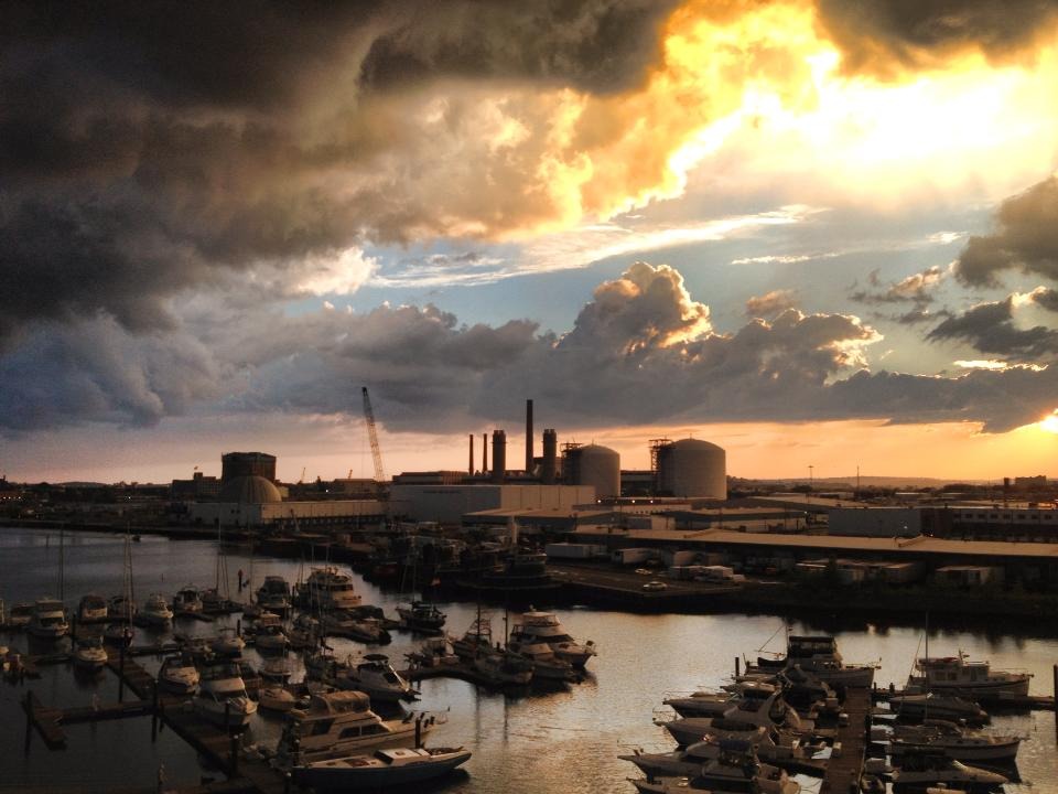
The Mystic River in Massachusetts flows from the Mystic Lakes in Winchester and Arlington, through Medford, Somerville, Everett, Charlestown and Chelsea, and into Boston Harbor, and has supported a long history of economic progress in one of the most densely populated urban areas of New England. Today, the Mystic faces serious water quality problems, shared by urban water bodies around the world: pollution from leaky sewer pipes, waste disposal sites; excessive nutrients and discharges of raw sewage; fuel hydrocarbons; and road salt. Portions of the watershed often fail to meet state bacteria standards for swimming and boating, and its Alewife Brook subwatershed is one of the most contaminated water bodies in Boston. The Mystic River watershed received a ‘D’ from the US EPA on its 2012 water quality report card.
Several organizations are engaged in water monitoring projects for the Mystic, but the high cost and ‘closed data’ nature of current technology severely limits the scope of current efforts, and makes data sharing difficult.
Water Quality Monitor Prototypes
Our main focus at first is on developing open hardware alternatives to the current most common water quality monitoring sensors, which measure temperature, conductivity, and water depth.
Tracking temperature over time at several locations along a river allows researchers to detect unusual trends in river water temperature -- this might help locate pollution sources along the river, and helps assess whether the water temperature is amenable to fish.
Conductivity is a useful measure for a variety of water quality issues, including excess salinity (usuall due to road salt), dissolved solids, and other sources of water pollution.
Measuring water depth along with these other parameters allows researchers to correlate temperature and conductivity with storm events -- helping to determine the relative contribution of stormwater runoff and combined sewer overflow events to changes in river water quality.
Our initial goal is to develop open source, low-cost dataloggers that measure these various parameters over time, storing data on board the datalogger, with batteries that last for several months. Volunteers will then build and deploy these sensors at various locations in the watershed, and go out to collect data from them (using laptops) months afterwards, submitting the data to an online data repository.
We'll be collaborating with MyRWA and Plymouth State, who already have citizen science volunteer networks who have been using a similar approach, but who previously needed to rely on much more expensive devices with encrypted data formats. This low-cost, open approach will allow the volunteer community to collaboratively build, maintain, and improve the sensor technology they'll be using, and share the resultant data among themselves as well as with researchers and water resource managers.
We're currently basing our data logger prototype on an open source hardware project: the "mchck" -- an inexpensive, low-power microcontroller design with on-board flash memory, and 'real time clock'. This means that it can function as a low-cost, long-lasting datalogger.
Our fork of the mchck project is here, with datalogger functionality implemented here.
The "water quality shield" we're developing for the mchck will include hardware for measuring conductivity, temperature, and water depth is here.
Here are some nice D3 libraries that might be useful.
STE(A)M Curricula
As we develop a water quality open hardware platform, our hope is to incorporate this same technology in middle school and high school environmental science programs. We've partnered with Plymouth State and the Amherst Middle School to explore the best ways of doing this. The Amherst Middle School has already developed water quality curricula that involved deploying sensors in the Fort River in Amherst, MA, but the proprietary, encrypted data nature of the sensors they were using made progress difficult. We'll be leveraging the curriculum materials they've already built in order to develop online, open source water quality curricula that educators everywhere can contribute to and share. The focus will be developing a comprehensive STEAM approach -- Science, Technology, Arts, and Mathematics -- of the sort pioneered by RISD; allowing students to design their own visualizations and interpretations of the environmental data that they collect themselves.
Online Visualization of Water Quality Data
We're going to be working with Patrick Herron, Mark Green, Jeff walker, and Mary Martin to find accessible and compelling ways of displaying water quality data online.
For use in prototyping our online visualization system, Mary Martin has provided a link to real-time river depth and precipitation informationfrom the Hubbard Brook Ecosystem Study in New Hampshire. Their current visualization is here.
Patrick Herron has provided a dataset that is a single sensor reading from a polluted waterway on the Alewife Brook, here: ALB006.txt
Jeff Walker has already developed code for visualizing streamflow csv data using D3, based on a D3 reusable chart pattern.
Updates


Above: a design for a 3D printable plug that will nicely contain the sensor electronics, and hold the conductivity wires in place.

Above: the first version of a 3D printed enclosure, which connects to a common PVC screw cap for a waterproof seal.
Update: Amherst College Martin Luther King Day of Service Mini-Hackathon!
We got together and prototyped some visualization / data analysis software for the water quality project. Check out our progress here!


- Google Doc for MiniHackathon Notes
References
- "Effects of road salt and Phragmites australis invasion on the vegetation of a Western Massachusetts calcareous lake-basin fen" -- paper
- Powerpoint presentation on the effects of road salt.