Gulf Coast
[toc]
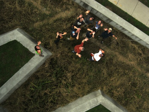
Since May 2010, we have been using balloon mapping to capture aerial imagery of spill-affected sites in Louisiana, Mississippi, Alabama and Florida. Our work on the Gulf Coast has been done in cooperation with groups such as the Louisiana Bucket Brigade and the University of South Alabama on a community-led monitoring of the Deepwater Horizon oil spill. The data we have gathered can be viewed at:
http://grassrootsmapping.org/data
orhttp://publiclaboratory.org/wiki/maps
More images and information can be found at:
- https://www.flickr.com/photos/tags/gulfoilmap/
- http://unterbahn.com/thesis - Chapter 8: Case Study: Citizen mapping of the BP oil spill (5.7 mB, 14 pages)
- and in the various press and publications listed at http://publiclaboratory.org/media
We’re not trying to duplicate the satellite or flyover imagery (though we’ve helped to coordinate some of the flyovers and trying to ensure that the data is publicly accessible). We are helping Gulf Coast residents to use balloons, kites, and other simple and inexpensive tools to produce their own documentation of the spill… and hoping that such data collection will support environmental research, policy, and regulatory changes in coming years.
Current focuses (May 2011) include:
- Producing our first paper map (with the support of DevelopmentSeed) of Wilkinson Bay.
- Providing digital archives of collected images to libraries across the Gulf Coast
- Mapping at Helen Woods Park in Mobile Bay, Alabama where an oyster reef is being constructed by hundred of volunteers
- Continued mapping at sites in Louisiana including Grand Isle, Bay Jimmy, and other areas in the Barataria region
- Connecting with researchers regarding data use and potential collaborations
- Testing out new PLOTS tools- infrared and UV cameras
Grassroots Mapping: Kickstarter Pitch from TungstenMonkey on Vimeo.
We're organizing mapping 'trips' on the coast. If you're interested in participating in a trip or conducting your own mapping session, please contact us at the mailing list, and we'll help you get started. (equipment, training, finding volunteers, etc.)
Team
- Shannon Dosemagen - Public Laboratory (shannon@publiclaboratory.org)
- Cesar Harada
...feel free to add your name!
Contact information
- Grassroots Mapping Mailing List - please join, this is how we can reach you with meeting announcements, etc.
How can you help?
- Sort imagery we've collected so that it can be stitched into maps
- Sponsor the printing of one of our maps to be distributed on the Gulf Coast
- Help us find boats in the Gulf Coast area for mapping trips
- Volunteer in the area to fly balloons/kites, make maps Volunteer Here
Equipment:
- Canon cameras or Android phones (see CameraOptions)
- Weather balloons (5 feet diameter or more)
- 100-gallon trash bags
- string, lots of string
Mapping Resources
- NOAA's latest prediction maps -- PDFs available for 24, 48, and 72 hour horizons
- Latest MODIS imagery - often cloud-obscured
- etc. mapping resources-- pulled from posts to grassrootsmapping google group
Other mapping efforts
- LA Bucket Brigade Ushahidi instance
- CrisisCommons: Dr. Eric Frost, "Viz Lab" at SDSU San Diego: bio, crisismapping profile
- Skytruth is doing regular analysis of satellite imagery of the spill.
How-to Mapping Guides
Look at our 4-page PDF guide to get started.