Gulf Coast
The Public Lab Gulf Coast office is located in New Orleans, LA at 4035 Washington Ave. You can join other Gulf Coast Public Labbers through our Gulf Coast Google Group (https://groups.google.com/forum/#!forum/plots-gulfcoast), where we announce events in the Gulf Coast region and projects that you can get involved with. If you're interested in proposing a project, a new focus in the Gulf Coast region or want to conduct your own mapping session, please contact us, and we'll help you get started (equipment, training, finding volunteers, etc.).
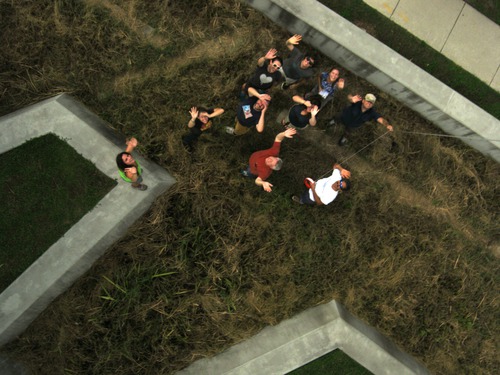
Gulf Coast Organizers:
Oscar Brett
Dan Beavers
Hunter Daniels
Scott Eustis
Eric Kugler
Matt Pendergraft
Alex Stoicof
2014 Plans and Projects
MapKnitter Club meetings are hosted every other week. If you're interested in the technical side of making maps and want to get involved, please join the plots-gulfcoast@googlegroups.com list where planning and announcements happen.
Continued mapping of Barataria Bay. If you're interested in getting involved-- participating in mapping trips or doing image stitching -- please contact Scott Eustis or Shannon Dosemagen. Contact information is below. We'll be using a wiki page to organize this project: http://publiclab.org/wiki/barataria-bay-mapping-project.
2013 Plans and Projects
2013 Barnraising. The 2013 Barnraising is fast approaching! For more information, or to reserve your space, visit this page: http://publiclab.org/wiki/barnraising-2013.
Public Lab recently received a contribution from Patagonia Clothing Company to do aerial mapping of twenty sites in Barataria Bay that grassroots mappers had previously worked at in 2011. The project is set to run between October 2013 and October 2014.
Public Lab has been working with a team at NASA DEVELOP, based at Stennis Space Station, using the DIY spectrometer to look at refinery flares. To view related research notes, search for the tag "flare".
Public Lab will be participating in DredgeFest Louisiana, mapping five sites ahead of time and collaborating with the Dredge Research Collective to create annotated maps that will be used during the main DredgeFest event in January 2014. To get involved, please contact Scott Eustis or Shannon Dosemagen.
The Gulf Coast region will be piloting a "Map Stitching Team". Similar to the work done during the BP oil spill in 2010, the corp will be a way for people, from anywhere in the world, to get involved in helping to provide technical assistance and do image stitching of data being collected in the Gulf Region, specially during the Barataria Bay project. To get involved, please contact the Public Lab Cartography Collective.
Deepwater Horizon Oil Spill Mapping 2010-2011
Since May 2010, we have been using balloon mapping to capture aerial imagery of spill-affected sites in Louisiana, Mississippi, Alabama and Florida. Our work on the Gulf Coast in 2010, was done in cooperation with groups such as the Louisiana Bucket Brigade and the University of South Alabama on a community-led monitoring of the Deepwater Horizon oil spill. The data has been gathered can be viewed in:
the Public Laboratory Archive »
More images and information can be found at:
- https://www.flickr.com/photos/tags/gulfoilmap/
- http://unterbahn.com/thesis - Chapter 8: Case Study: Citizen mapping of the BP oil spill (5.7 mB, 14 pages)
- and in the various press and publications listed on our media page
While mapping the oil spill, we were not trying to duplicate the satellite or flyover imagery (though we helped to coordinate some of the flyovers and tried to ensure that the data was publicly accessible). Instead, we were helping Gulf Coast residents to use balloons, kites, and other simple and inexpensive tools to produce their own documentation of the disaster and hoping that such data collection will continue to support environmental research, policy, and regulatory changes in coming years.

2012 Mapping Plans and Ideas
Bayou Bienvenue [background] [restoration] [greenslice]
NO East (schools, Nature Center) late December 2012
Big Branch map annotation
Cypress Restoration on MRGO spoilbank (St Bernard Foundation) January 2013
2011 mapping plans and focuses
- Producing our second paper map (with the support of DevelopmentSeed) of Wilkinson Bay.
- Providing digital archives of collected images to libraries across the Gulf Coast
- Mapping restoration and remediation efforts in the Louisiana wetlands
- Continued mapping of the Barataria Bay region in partnership with the Louisiana Universities Marine Consortium
- Connecting with researchers regarding data use and potential collaborations
- Testing out new PLOTS tools- infrared and UV cameras
- Testing out a time lapse camera that will be mounted in a wetland area near Cocodrie, LA
- Testing the Hydrogen Sulfide sensor that is currently in development
Grassroots Mapping: Kickstarter Pitch from TungstenMonkey on Vimeo.
Site Contacts
- Shannon Dosemagen - Public Lab (shannon@publiclab.org)
- Scott Eustis - Gulf Restoration Network (eustatic@gmail.com)
- Becki Chall - Public Lab (becki@publiclab.org)
- Dan Beavers - Public Lab Organizer (danbeavers@organizers.publiclab.org)
Join
- Join the Public Laboratory community - please sign up for the plots-GulfCoast mailing list, this is how we communicate local events.
How can you help?
- Sort imagery we've collected so that it can be stitched into maps
- Sponsor the printing of one of our maps to be distributed on the Gulf Coast
- Volunteer to help with data analysis and outcomes
- Volunteer in the area to fly balloons/kites, make maps Volunteer Here
- Volunteer your expertise around further development of H2S sensing and the infrared camera
How-to Mapping Guides
Look at our 4-page PDF guide to get started.
Equipment:
- Canon cameras or Android phones (see Balloon Mapping Materials)
- Weather balloons (5 feet diameter or more)
- string, lots of string
Mapping Resources
- NOAA's latest prediction maps -- PDFs available for 24, 48, and 72 hour horizons
- Latest MODIS imagery - often cloud-obscured
- etc. mapping resources-- pulled from posts to grassrootsmapping google group