We're working to support the reporting of pollution incidents following Hurricane Harvey
1. Search the map for industrial sites
We need to help the Gulf Restoration Network and other community based orgs make a list of image URLs for as many sites from this map as possible:
NOAA map post-storm: https://storms.ngs.noaa.gov/storms/harvey/index.html

If you're not sure where to start, look through these lists of industrial sites:
https://publiclab.org/wiki/harvey-images#Industrial+sites+in+TX
If you are using the NOAA Harvey map, you can go on to Step 2. Otherwise take a screenshot and upload it using these instructions.
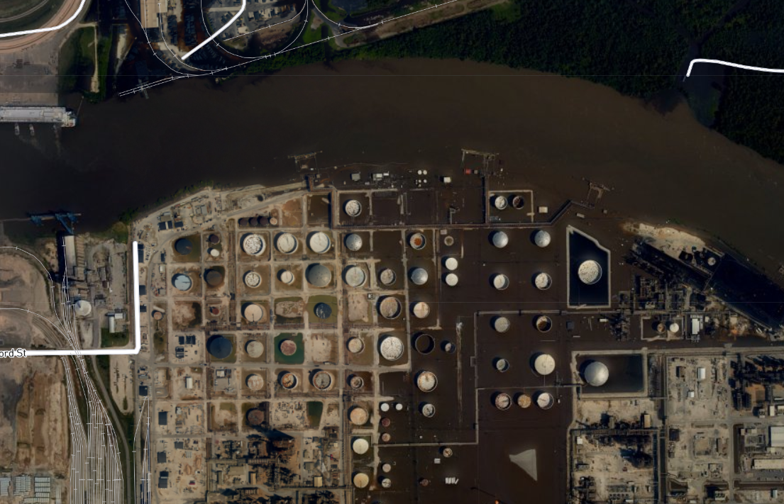
See this example view of the NOAA Harvey map, near Beaumont, TX:

2. Make an entry in the spreadsheet
If you're using the NOAA map viewer, you can just copy the URL for the current view you're looking at, and it'll include the location's coordinates and a "permalink" back to that exact location. Paste this into the Image Link column.
(For non-NOAA images, you can just add the filename and a link to where the image can be found, so just Filename, Image URL, and Location.
For the above image, the URL was:
https://storms.ngs.noaa.gov/storms/harvey/index.html#16/30.0727/-94.0695
(note the latitude and longitude at the end of the URL)
We can follow up in another activity with further observations and notes, but if you can see more, go ahead and follow the instructions on the spreadsheet to fill out additional information.
Get started
Go ahead and begin entering data in the spreadsheet below! Ask any questions about the process in the comments below. Thanks!
4 Comments
I created a web based map that shows Sierra Club's toxic sites and Harvey Ecological Hazards Map on top of NOAA's imagery https://arcg.is/0LTizq
If there are other lists or maps that are available with geo data I can add them.
Reply to this comment...
Log in to comment
wow that's great! Thinking about hosting an event in New Orleans to work on this. I'll feed back in notes on when/where once that develops and we'll post back.
Reply to this comment...
Log in to comment
We're hosting an event using this workflow tonight at the Warehouse in New Orleans, 3014 Dauphine Street from 6-8! https://publiclab.org/notes/stevie/10-10-2017/event-sorting-images-from-harvey
Reply to this comment...
Log in to comment
The spreadsheet was briefly unavailable but is now back online, thanks!
Reply to this comment...
Log in to comment
Login to comment.