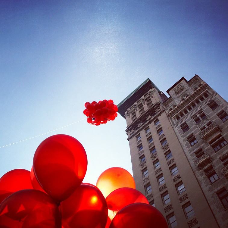
(above image by @C_Eich in Union Square, NY)
Public Lab is working on a campaign to relaunch our Balloon Mapping Kit, and to that end we're hoping to round up images and/or video showcasing your kite and balloon photography over the years!
We'd love to see documentation of all kinds of projects: large-scale research missions, backyard surveys, successful (or unsuccessful) experimentation, works in progress, or anything else you can think of that gives insight into aerial mapping and your work with the process. Completed maps and action shots of mapping teams are all welcome! As long as you put something up in the air (or TRIED to put something up in the air), we'd love to take a look.
Feel free to post photos, videos, links, and any commentary you wish directly into this post or the comments. Many thanks!
20 Comments
Redirected from previous wiki page -- and moving @xose's photos here; thanks!!
Reply to this comment...
Log in to comment
Research sites in northern Alaska as depicted from kite images
Reply to this comment...
Log in to comment
Barcelona, april 2015, with @pablo
Reply to this comment...
Log in to comment
Ecuador, November 2015, with @MateoNeira @sebasvanegasb @NataCabrera @JuanSardi
China, January 2016 with @shanlter and the GreenovationHub crew, flying kite to start understanding excess sediment in water supply to rural village in Guanzxi Zhuang autonomous province
Also with @shanlter and the GHub crew Looking for helium during Chinese New Year (can you spot the PL balloon box in each photo?)
Is this a question? Click here to post it to the Questions page.
Reply to this comment...
Log in to comment
I think the very first is @bronwen's ;)
Reply to this comment...
Log in to comment
Oops, sorry!
Reply to this comment...
Log in to comment
Reply to this comment...
Log in to comment
@genawirth and The Dredge Collaborative, more here: https://publiclab.org/profile/gwirth
Reply to this comment...
Log in to comment
There are a LOT of amazing Gowanus photos of canoes in all sorts of water conditions, from frozen to milky white with the carcasses of sewage-gorging bacteria. Assuming @bronwen can find these, otherwise, i can upload!
Reply to this comment...
Log in to comment
Reply to this comment...
Log in to comment
Above: Balloon mapping agricultural study plots (the first iFarm, May 2012). Photo, Chris Fastie.
Above: Balloon mapping agricultural study plots (the first iFarm, May 2012). Near infrared photo, Chris Fastie.
Above: Balloon mapping agricultural study plots (the first iFarm, May 2012). Photo, Chris Fastie.
Above: Bristol, VT landfill balloon mapping workshop, October, 2016. Photo: Shaina Kasper
Above: A rare discovery from the Public Lab archives. A youthful Admiral Von Hindenberkenstock launches a balloon mapping prototype. Credit: unknown
Reply to this comment...
Log in to comment
Reply to this comment...
Log in to comment
Above: @mustafa10 demonstrating a balloon with Redstone Rig and pendulum suspension. I think this happened in Berlin. I don't know who to credit for this photo.
Reply to this comment...
Log in to comment
Awesome pictures! Kelly Taylor from @partsandcrafts sent these in, too!
https://www.flickr.com/photos/wmshc_kiwitayro/albums/72157629849309859
Reply to this comment...
Log in to comment
When I couldn't find any free, high-resolution aerial imagery of my coral reef study site, @glennon introduced me to BAP and KAP. Since then I've used it to for mapping but also as a way to teach students in California and Indonesia about remote sensing for environmental monitoring.
Map-reading isn't a universal skill. I've found that the process of shooting and then arranging aerial photos into a mosaic helps people connect their ground-based perspective with the aerial perspective of a typical map.
Reply to this comment...
Log in to comment
(Inflating and preparing for launch with Steven Ruiz, pictured)
Reply to this comment...
Log in to comment
Ballon Mapping and Photogrammetry tests conducted September 2017 at the Desert View Conservation Area (section) adjacent to Joshua Tree National Park, CA.
Reply to this comment...
Log in to comment
Photogrammetry produced from the flight over Joshua Tree, Desert View Conservation Area, using student edition of Autodesk Recap.
Reply to this comment...
Log in to comment
Balloon Mapping at the Amboy Crater, CA.
Photogrammetry produced with Autodesk Recap, Student Edition. Rendered with Cinema 4D R18
Reply to this comment...
Log in to comment
Wow gorgeous images and models!!!!
Reply to this comment...
Log in to comment
Login to comment.