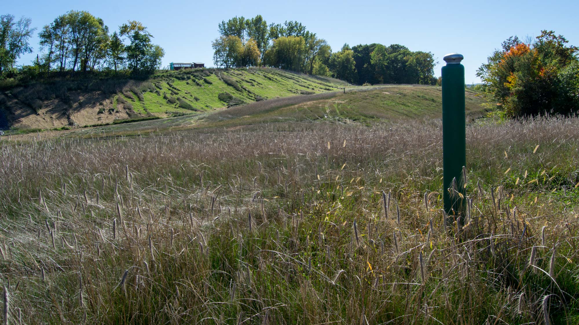
Above: A high point on the capped surface of the retired municipal landfill at Bristol, VT. At right is one of several methane vents which release the gas into the air. Vegetation appears to include the dried stalks of winter rye (Secale cereale), a fescue grass (Festuca sp.), and red clover (Trifolium pratense). A patch of yellow bristlegrass (Setaria pumila) is near the methane vent.
Public Lab organizer Sara Wylie led a balloon mapping demonstration at the recently retired municipal landfill at Bristol, Vermont today. It was a gorgeous day with the rare conditions that allow both balloon aerial photography and kite aerial photography.

Above: The balloon was inflated to a bit under five feet in diameter.
The Bristol landfill has no impervious liner under it and if fact was built directly in the sandy foreset beds of a 13,000 year old pro-glacial delta. Much to the delight of geomorphically aware observers, the landfill was closed in 2015. The pile was contoured and capped with about two feet of Omya SPS, a byproduct of a local marble mining operation:
Omya produces high quality calcium carbonate products which are used in the manufacturing of paper, paint, plastics, food and pharmaceuticals and various other
products. The processing of our raw material, marble ore, also yields a by-product,
Omya SPS. Omya SPS is a mixture of calcium carbonate and other minerals. Due
to its mineral content, low permeability, small particle size, inherent alkalinity and
its ability to support vegetation, Omya SPS has found a home in many applications
as an economical, environmentally friendly alternative to traditional fillers and
extenders. Omya SPS has also proven to be an excellent agricultural liming agent
and landfill cover. (Source)
From a quick survey of the vegetation, it appears that the mixture of seeds planted on the surface of Omya SPS in 2015 included winter rye (a coarse annual grass), a fescue (a fine perennial grass), and red clover (a sturdy perennial legume). The winter rye produced a huge crop of seeds this past summer, and the fescue is starting to form a sod under the rye stems. Clover establishment is spotty. Large areas on the sloping sides of the mounds eroded into gullies during rain events before the grass seedlings stabilized the soil. These areas have been recently repaired and reseeded (no emergence above the mulch yet). These repaired areas are conspicuous in the aerial photos as light tan strips along the fall line of the slopes. White patches are bare areas of the Omya SPS.
A south wind between 6 and 10 mph was perfect for flying a kite over the landfill from the high school playing fields on the old deltaic surface. I flew a Fled kite which lofted a Saturn V Rig with PowerShot S100. Every 80 seconds the camera took 25 photos covering the entire 360° sphere except for the zenith. The camera captured 1000 photos during the 50 minute flight. I walked the kite around to get nadir (vertical) coverage of the entire landfill. Three photos in every sequence of 25 were nadir photos, and 31 of these were auto-stitched by Microsoft ICE into an "orthophoto." This stitching process has no geographic control, so the resulting image probably has some rectification errors. But it looks nice.
The full resolution stitched image is embedded below from Photosynth.net. Photosynth does not allow the orthographic projection to be uploaded, so I had to use some other projection (can't remember which one but they're all similar at this scale). Here is the image at Photosynth.
Above: Stitched "orthophoto" of the Bristol landfill. This is approximately an 80 megapixel image. The large white area at upper left is a sand and gravel quarry and is not part of the landfill. North is up, more or less.
Here some other notes about this KAP session:
0 Comments
Login to comment.