DRAFT
What I want to do
Continue to document the establishment of the wetland restoration at the mouth of bayou st john --a delta?
Andy Baker is still trying to come up with a good name--people hear "Bayou St John wetland" and they think about the Cabrini Bridge or Parkway, where the festivals and soccer games are held. "Mouth of Bayou St John" is not a place that our urbanized New Orleanian population can intuitively locate on the map.
"Bayou St John restoration" sounds like we are restoring a river. Which is part of the plan, but this is ancillary to that effort--the channel was dredged to restored the river functions, and we asked, and Andy built, a wetland with the beneficial material.
For this reason, I've had more success calling this place "the fishing spot" or "the make out spot," or "where people have their dogs." Because there is no road close by, policing is minimal--a cop would have to get out of his car.
It's also know locally as near Spanish Fort, among history buffs. Spanish Fort is a mostly unrecognized historic structure nearby, that may be googleable. But that location name is not correct for this site.
Perhaps the Bayou St John Delta? "Delta St John"? "Delta Jean"? the bayou technically flows into New Orleans, so that also feels a bit wrong. "Marsh Jean"? We'll keep trying to name the place.
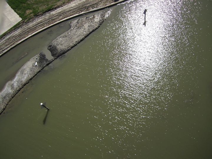
Anyway, the placed material is constantly moving before Andy and co have been able to plant roots into the sand. Kite and bridge photos can help document what is going on at the site to funders, to donors of in-kind bobcat time, and to volunteer bayou diggers.
My attempt and results
The wind is curious at this site. Despite being ever available, it seems ever gentle. I flew the east side with the little bear, I flew the west side, and i flew off the bridge in order to get the right angle, and full coverage of the built wetland. I flew a soda bottle rig, and did not get very much altitude.
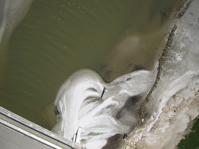
But the bridge provided a valuable perspective by itself. A walk over the bridge could be included as part of our wetland education efforts.

Here you see the migration of shells into the formerly deep channel, which makes the recently installed signage a bit out of place. This photo came from the bridge.
Questions and next steps
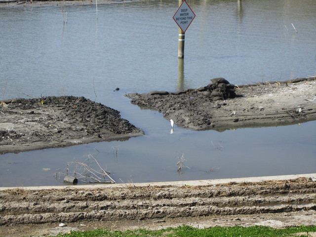
Andy Baker "Thank you Scott! Your photos are an amazing perspective on our ongoing wetland creation project. On this morning, two hard-core volunteers and I hand dug the channel at the upper left. It's the first of 3 on that side, and will provide hydrologic connection with the new lagoon to increase habitat function."
Channels will continue to be dug, and plant will grow throughout this year. the planting schedule is below:
"We are gearing up for lots of volunteer digging and planting throughout March. We'll plant at least 10 species of grasses, sedges and rushes to stabilize the new wetlands before hurricane season.
Spring 2014 Volunteer Days for Bayou Saint John Marsh
Sat 2/15 9 to 1 Digging and cleanup
Sat 3/8 9 to 1 Digging and planting
Sat 3/15 9 to 1 Digging and site prep
Sun 3/16 1 to 5 Site prep, cleanup and crawfish boil
Sat 3/22 9 to 1 planting
Sat 3/29 9 to 1 planting and cleanup
Looking for volunteer groups in these windows:
Tue 2/11 to Sat 2/15
Tue 2/18 to Thu 2/20
Thu 3/6 to Sat 3/8
Wed 3/12 to Sun 3/16
Tue 3/25 to Thu 3/27
Contact saintjohnwetland AT gmail.com for more information or to sign up.
Andy Baker
Wetland Biologist, LPBF"

Carto Collective: in mapknitter: not done
Why I'm interested
This is a site that has tremendous ecological value but could have much more. It is a perfect opportunity to engage the lakegoing public about the value of Louisiana wetlands.
1 Comments
Anyone know where the original image set is for the map associated with this note? The map was completed and put in the Archive here: http://publiclab.org/map/coulee-baker-bayou-st-john-new-orleans-louisiana/03-02-2014
There are a couple images i'd like to adjust so that it overlays really well with the other maps of this site.
Is this a question? Click here to post it to the Questions page.
Reply to this comment...
Log in to comment
Login to comment.