Subscribe
The Public Laboratory prints a periodic paper map, known as the Grassroots Mapping Forum from one of our partner communities -- so far we are readying the first issue for press, but we hope to eventually print monthly.
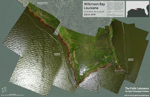
For the time being, we are accepting pre-orders for our initial issue of the Grassroots Mapping Forum, printed on a 22.75x35" sheet folded down to just over letter size. It includes a full color image of an oil-struck island in Wilkinson Bay, Louisiana, and essays, illustrated guides, and interviews on the reverse.
$15.00 - https://www.wepay.com/shop/item/895558/657841
Your full-price purchase subsidizes free and discounted distributions to Gulf Coast residents and selected libraries, community organizations, and residents of the Plaquemines Parish area; email team@publiclaboratory.org for details on free and discounted copies.
About the Grassroots Mapping Forum
We imagine the Forum as a two-way publication- the full-color map is complemented by a cyan-colored map on the reverse side, ready to be marked up with new details about the site, mailed back to the Public Laboratory team, digitized, and included in the online map. This is community cartography, and we look forward to working with you!
