Posting about the Mapping Blitz event we ran here in New Orleans on October 11th.
An amazing group of mappers came out on Saturday for the New Orleans Urban Water Restoration Mapping Blitz. For 11 of the 14 mappers, this was their first trip!
Four groups set out all over the city, armed with cameras, infragram cameras, balloon kits, poles, rigs, tarps, and all the fixings for a great mapping trip!

Each group was given a pamphlet for each site they were going to map. These included a google aerial image of their site, a map of the location, a pictures of where they could map from, a site description with some background information and directions from the library to their site.


Overall, six of the Urban Waters sites were mapped.
Bayou St. John’s Urban Waterway was mapped by Brian Ruiz and Ryan Crassionnie. They were both first time mappers and used a pole designed by @gclout01 to map the site. Site notes from this group include that their first attempt at mapping the site they found that the pole was directly above them and they ended up with a lot of shots of their feet. Their second attempt was really successful and got excellent shots of the vegetative planting at this site. Brian and Ryan noted that the pole worked really well, but noted caution that the T bar on it should be taped in place as once they had completed the site mapping, one of the bars fell out. Brian and Ryan emphasizes that had this happened during their mapping they would have lost the camera!

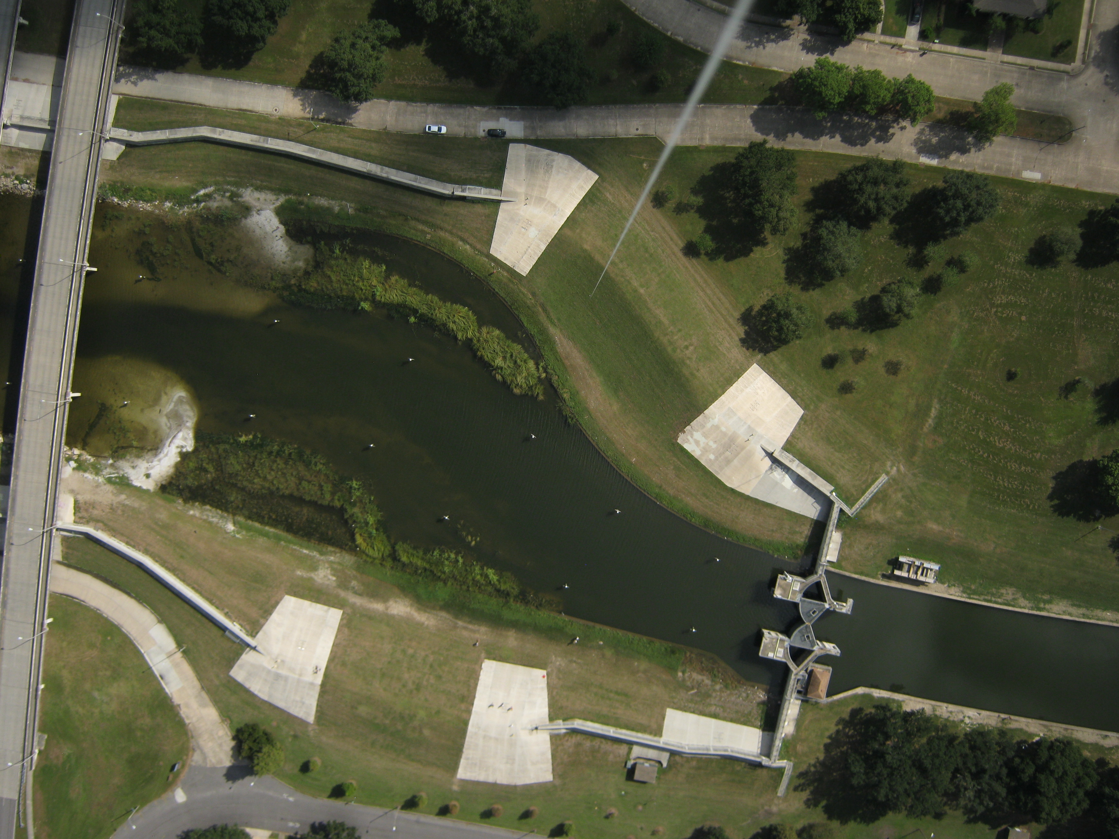
Bayou Bienvenue’s Shore Line Restoration site and the Waste Water Treatment site were mapped by first time mappers Gerald McCollam, Leslie Williams, Molly Gordon and Claire Loudis. The group made the smart decision that the Shoreline Restoration site was too close to a power line and opted to try pole mapping instead of using the Balloon. They experienced a little bit of difficulty with their pole and were worried that the set up they had would damage it. They opted to use Gerald’s Titan 2 to take a few shots of the site. Check out Gerald's write up about their experience here.

The same group had an excellent mapping experience at the Bayou Bienvenue Waste Water Treatment site. They were able to get the regular camera and the infragram camera up the full 1,000 feet without difficulty.


The Bayou St. John at Lake Pontchatrain site was mapped by Dan Beavers, Dan Henry and Brandi Caro. They had a great flight and took some excellent photos. One comment Dan Beavers had was that they might have been on the wrong side of the bayou because of the wind direction. This group then went to map the Stormwater Wetlands at City Park. Using Dan Henry’s van, they were able to role the balloon in the back and safely transfer it between the sites.

At the Stormwater Wetlands at City Park site, the group had some trouble with the camera, as their photos came out blurry. After returning to the Library, Dan Henry, Brian Ruiz and Ryan Crassonnie went back out to attempt the site again. These photos, although perhaps more stable, came out really dark, but the Infragram worked really well!

The Nature Center site was mapped by Scott Eustis, Tim McLean, Lauren Sullivan and Amy LeGaux. The group had a successful first mapping with the infragram camera, but when they reeled it in they accidentally popped the balloon on some bushes, this keeping them from a second flight.

Take aways:
- In the written pamphlets, include which sites the infragram should be used (I only told them in the morning, but I didn’t include it in their pamphlets). Also include what color the light on the infragram should be for the desired photo option (red).
- Figure out why the City Park site pictures were so dark.
- Take ground photos with the settings you will use to make sure the photos aren’t blown out.
- The PVC pole by @gclout01 worked better for our first time groups than the extended fishing pole, but we need to make sure the T bar is secure with tape.
- The Bayou St. John site can be mapped from either side, and is accessible on both sides. Best to choose the side with the wind at your back.
- The Rosa F. Keller Library was an excellent place to host this event from! We were able to borrow 8 computers and a projector. It was a great space for us to come back to. The staff was so helpful getting us supplies and making sure we had everything we needed. We had plenty of room for lunch and working together on image sorting. Plus, it’s really beautiful!
- One of our SD cards got erased! Unfortunately it was the one that had our group photos, the two runs of city park and Bayou St. John at Lake Pontchatrain. I am pretty sure they are on @eustatic hard drive.. but alas, no photos here.
Next plans:
- We'll be doing a map knitting session on Thursday October 23rd! Join us!
- Look for our maps to come from this project on this wiki page.
- Get all of our photos to the Google drive and share them out :).
4 Comments
The pamphlets are HOT! DId you make them, stevie?
Is this a question? Click here to post it to the Questions page.
Reply to this comment...
Log in to comment
awesome work stevie! I love the hand-made trifold pamphlets!
Reply to this comment...
Log in to comment
Yeah! :) Helped to make sure everyone knew where they were going!
Reply to this comment...
Log in to comment
These materials are beautiful! WOW
Reply to this comment...
Log in to comment
Login to comment.