What I want to do
Continue to encourage Engineers Without Borders (EWB) teams to consider simple aerial photomapping when appropriate for their projects.
My attempt and results
When I did a Simple Aerial Photomapping workshop at Engineers Without Borders Regional Conference at Cal Poly on 10/20/12, I learned the chapter had seen my prior workshops and applied these techniques with Pole Aerial Photography (PAP) for their project in India.
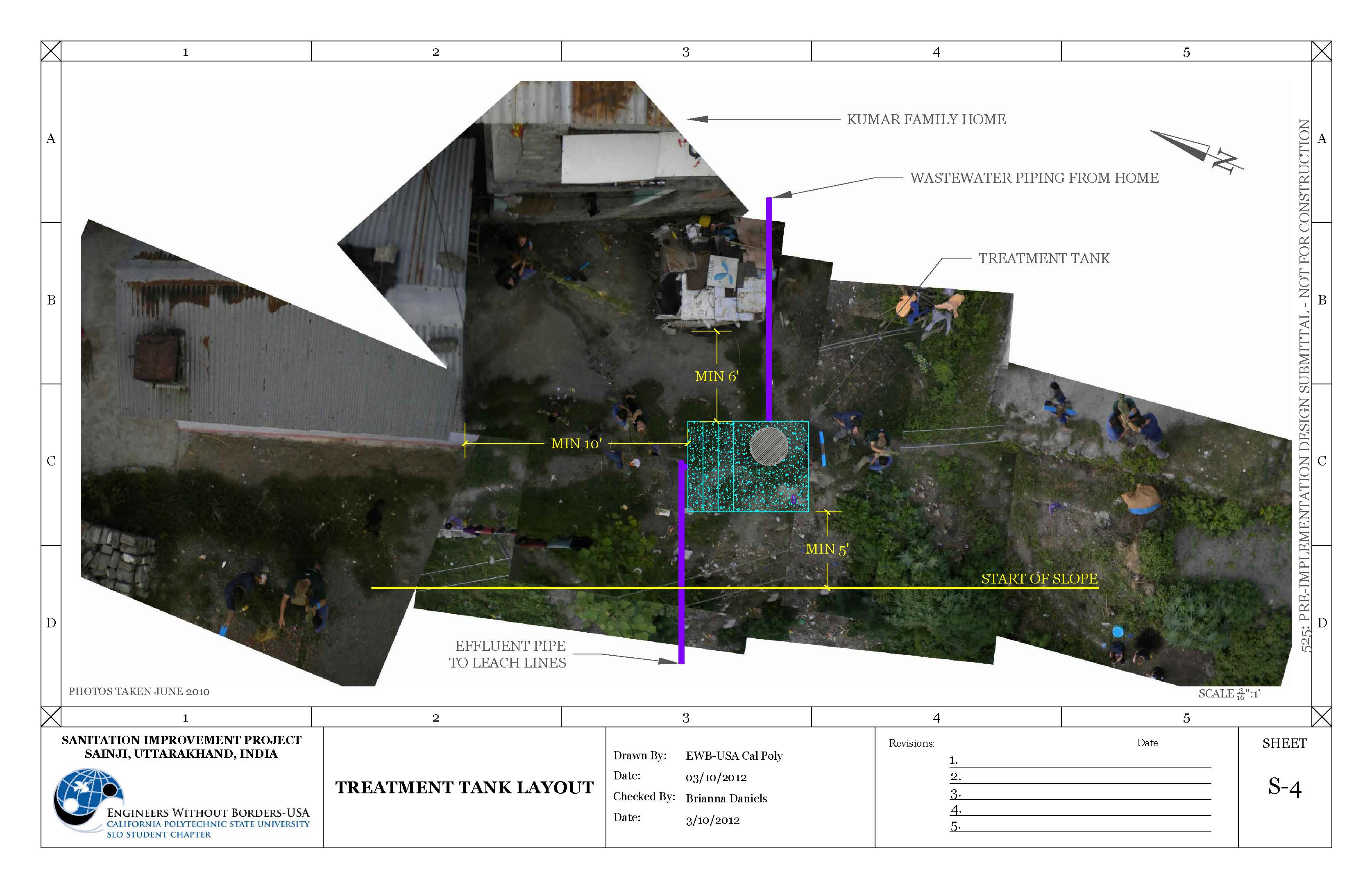
I was delighted to learn of their results and expressed interest in putting their results up as a Public Lab note. I finally got a few images of their rig and the results of their mapping as incorporated in their design drawing package. Specifically, see sheet 4, Treatment Tank Layout (the main image above) and sheet 3, a traditional site layout drawing, below.
Location:


Images of PAP rig:


Questions and next steps
I'd like to continue to explore the utility of these techniques for EWB teams.
Why I'm interested
Do it yourself (DIY) aerial photomaps can be very useful to EWB project team. They provide a low-cost means to create a record of events in map form, one that is temporally accurate, up to date, and easy to share.
1 Comments
I love the picavet on a pole, Pat! Great idea for stability.
Reply to this comment...
Log in to comment
Login to comment.