This storytelling exhibition showcases powerful aerial maps created by citizens using kites, balloons, and point-and-shoot cameras. We explore how people around the world are harnessing the power of Do-It-Yourself techniques to address local environmental, social and political matters.
Sitting around a proverbial campfire, we will tell four stories of unsung heroes in the U.S. and the Middle East, who have crafted tools and gathered evidence that has reconfigured the perception of space, place, and issues that shape their lives. Their maps take us on the journeys that reveal who created them: their challenges, struggles, and successes in achieving change in their communities. These maps lie at the intersection of technology, science, the environment, and social justice; they reveal the power of engagement and how people are creating alternative narratives of place and transformation.
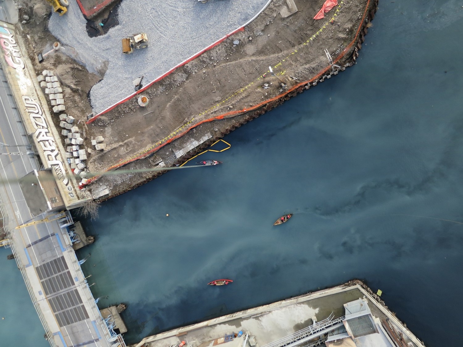
Aerial photograph of the Gowanus Canal in Brookly, NY post hurricane Sandy @eymund and @liz
Our stories
- "Gowanus Canal ghost streams" (Brooklyn, New York @eymund) - We have paved over our watershed to make way for urban landscapes. But once thought to be dead, the ghosts of historic creeks, veins of the city, are more alive than ever. However, it takes a keen eye, an understanding of common sense rules and investigative knack to find them - and fight for their restoration. These maps tell the story of how the historic streams are coming to life once again.
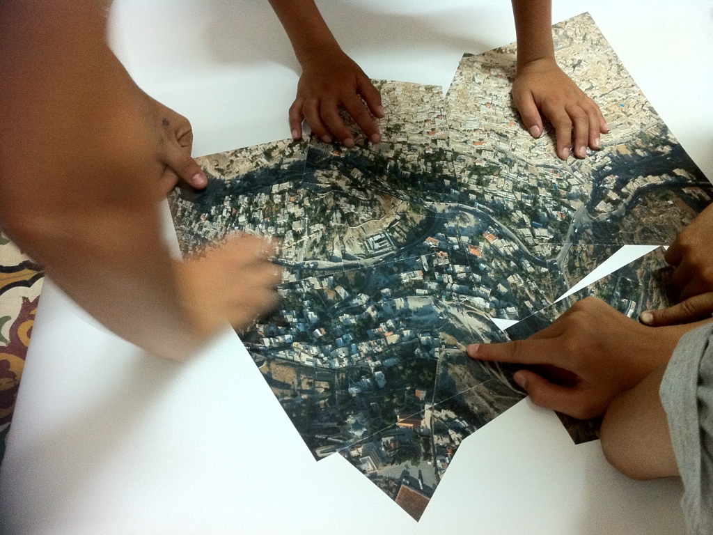
- "How to navigate a refugee settlement" (South Lebanon @clauds) - This is the story of a project centred in the community of inhabitants at Bourj Al Shamali, a Palestinian refugee camp in South Lebanon, whose engaged youth is using citizen science techniques to map and analyze their overbuilt, unhealthy environment with the goal of using this information to plan and advocate for future improvement initiatives.
- "After the spill: Gulf Coast restoration" (Louisiana, U.S. @eustatic) The environmental disasters created by the crude oil industry are rarely fully contained, especially in complex coastal landscapes. Long-term effects are also rarely documented but this has become the work of dedicated stewards who know the inner workings of these environments. Their work not only keeps wetlands' health monitored but also keeps their stories alive through aerial photographs that reveal who we are and where we want to go.
- "The spatial testimony - alternative strategies in human rights activism" (East Jerusalem @hagitkeysar). In this story DIY aerial photography was not used as a mapping tool as much as it enabled to create a photograph that made public - and visible - the structural abuse created by discriminatory planning practices, which cannot be grasped from the ground. It is a spatial testimony, narrated by victims who are also experts, bringing together the objectivity of aerial evidence with the subjectivity of a witness.
Where: Open space G04, Chadwick Building, University College London, WC1E 6BT, UK. Event is wheelchair accessible.
When: Saturday 18th Feb - Please note that we are open for three tours only - select your ticket accordingly [RSVP here].

0 Comments
Login to comment.