Shell Gulf of Mexico Oil Spill
Public Lab is part of the Gulf Monitoring Consortium, an alliance launched after the BP Disaster of 2010. Members and partners of the Consortium have been posting information about the recent Shell oil spill in the Gulf of Mexico, and we will be linking to those resources and updating this wiki page in the weeks ahead.
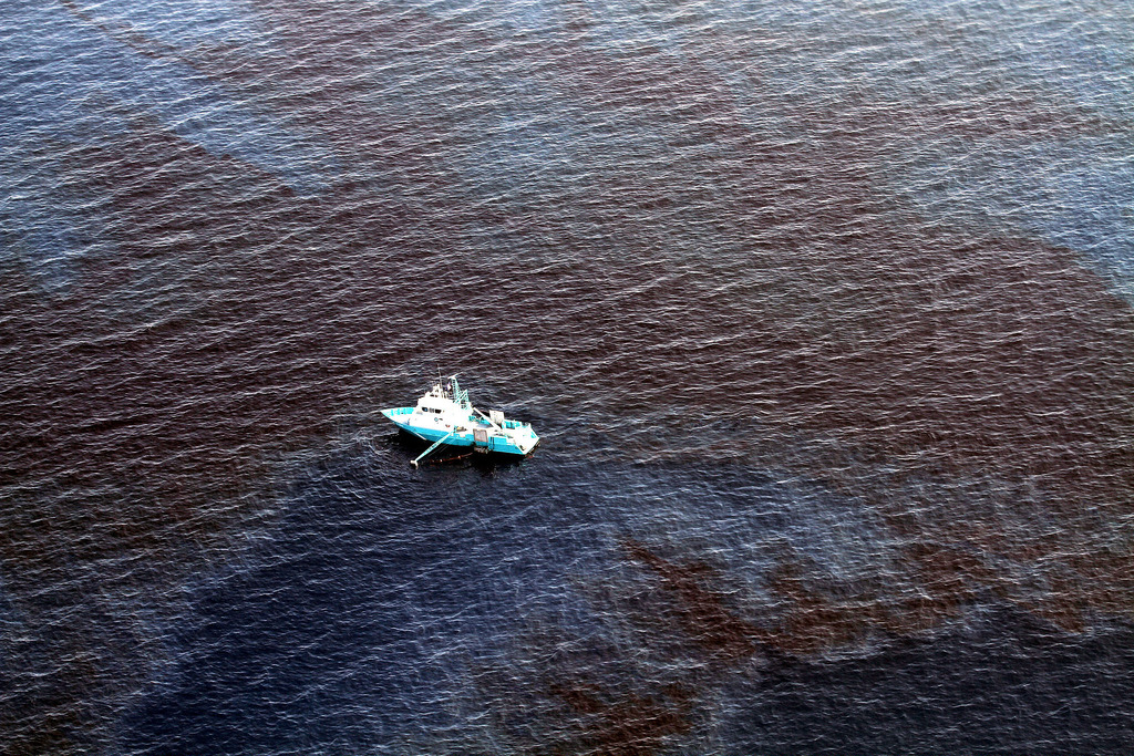
Currently, the spill is located 97 miles off the shore of Louisiana. Due to this distance asea, our particular tools and methods of aerial mapping are not easily applicable. As the situation develops, we remain open to helping where we can. We leave this page open for updates on the situation.
Documentation of the Shell Spill
Documentation from On Wings of Care: May 18, 2016 blog: Revisiting the site of last weeks Shell Oil Spill May 15, 2016 blog: Shell Oil Spill, offshore Gulf of Mexico Flyover video from May 15, 2016
Documentation from Vanishing Earth: May 18, 2016 blog: Unseen Video of Shell's Gulf Oil Leak May 14, 2016 blog: Shell Gulf of Mexico Oil Leak
Documentation from SkyTruth: May 20, 2016: Interactive map of existing oil and gas platforms and active pipelines in the Gulf. To use: Click on any platform and some helpful info pops up (name, block location, company, water depth, installed date, etc). Click on "visible layers" at upper right to toggle the data on and off. Enter a location in the search bar to zoom to that place. Or just manually zoom in and pan around at will. May 16, 2016 blog: Oil Spill Response is a Joke
Articles on Nola.com: May 16, 2016: Researchers in Gulf to Study Shell Oil spill May 12, 2016: Shell: Damaged flowline caused oil spill in Gulf of Mexico May 12, 2016: Shell spills 88,000 gallons of crude oil off Timbalier Island: Coast Guard
Video from Greenpeace USA [May 20, 2016 upload] (https://youtu.be/CY4JVpILqHY)
Additional Coverage: May 24, 2016 interview with Scott Eustis on WMNF: Update on impact of Shell Oil spill in Gulf of Mexico May 19, 2016 article from Desmog: Shell Oil Spill Cleanup Operation Ends As Voices Against New Gulf Drilling Grow Louder
Map being created by Scott Eustis (@eustatic) of Shell Offshore Inc's pipelines from the public BOEM data. If you are interested in contributing to this map, the BOEM data lives [here](http://www.data.boem.gov/homepg/data_center/mapping/geographic_mapping.asp.
Case Report in GRN's oil and gas report--[Shell's Glider Leak page 8] (https://healthygulf.org/sites/healthygulf.org/files/oilgasreportweb_final.pdf)
Key points of the crisis
- Started Thursday, May 12, 2016
- Spill of >88,200 gallons (2100 barrels) leaked from subsea pipeline
- Four subsea wells combine to Brutus platform; no drilling at these wells
- Coast Guard said Thursday that source of leak was secured; cause for leak under investigation; subsea oil field remains “shut-in” until cause and contributing factors identified
- Oil spill identified by Shell helicopter (GG note to self -- read more about why helicopter there)
- 97 miles off the shore of Louisiana
- Slick 2 miles x 13 miles wide
- Slick heading west, Shell says unlikely to reach shore
- Skimming oil from surface water to remove it
- Using IR aerial cameras to identify slick to be skimmed
- By May 16th, had removed 76,600 gallons of “oily-water mixture” -- not sure what that means in terms of volume of oil
- Bureau of Safety and Environmental Enforcement (BSEE) approved Shell’s plan and BSEE inspector will be onboard to observe recovery operations
Organizations on the ground
- SkyTruth: http://blog.skytruth.org/2016/05/oil-spill-response-is-joke.html
- Vanishing Earth: https://vanishingearth.org/2016/05/14/exclusive-footage-shell-gulf-of-mexico-oil-leak/
- No New Leases campaign: http://www.nonewleases.org/
Local public events around the issue
- The Green Army is hosting an action next week (Tuesday, 5/24) about the oil spill in the Gulf and ongoing pollution in St. Rose. (more info to follow)
- Support the “No New Leases” campaign
- Hands Across the Sand in Mississippi on May 21st
Questions being asked
- What technology was used for the leak detection system that doesn’t appear to have worked?
- How old was the pipeline that leaked? Enter Segment Number 12457
- From the BOEM data, can we decipher when pipelines were installed? (see BOEM data here: http://www.data.boem.gov/homepg/data_center/mapping/geographic_mapping.asp)
Media sources
- http://www.huffingtonpost.com/entry/shell-oil-spill-gulf-mexico_us_57353058e4b060aa7819ee00
- https://www.theguardian.com/business/2016/may/16/shell-gulf-of-mexico-oil-spill-leak
- http://www.offshore-mag.com/articles/2016/05/shell-s-glider-field-remains-shut-in-after-oil-spill-in-gulf-of-mexico.html *CBS
- http://www.fox8live.com/story/31975715/coast-guard-responds-to-oil-spill-off-louisiana-coast
- http://www.nola.com/business/index.ssf/2016/05/shell_oil_spill_gulf_of_mexico.html
Government response:
"Conclusions Based on BSEE’s investigation and all available data, BSEE concluded that the loss of containment in the Glider subsea system was caused by the ductile tensile overload fracture of the LLJ of the Glider #4 jumper. The ductile tensile overload fracture was caused by the bending loads imposed as a result of the partial burial of the Glider #4 jumper and subsequent subsidence of the subsea sled #2 (ref figure 7).
Based on BSEE’s investigation and all available data, BSEE concluded there were no manufacturing defects or anomalies in the components of the Glider #4 jumper, to include the LLJ.
Based on BSEE’s investigation and all available data, BSEE concluded Shell had knowledge of the burial and did not recognize and therefore did not fully assess all possible factors for the structural risk associated with the burial of the Glider #4 jumper system.
Based on BSEE’s investigation and all available data, BSEE concluded CROs were not cognizant of the possibility of subsea mechanical integrity failure due to the lack of training in subsea leak detection and the perceived robustness of the Glider subsea system. In addition, CROs incorrectly diagnosed the loss of pressure in the subsea system as a slugging event instead of a breach of the system. This directly led to the delay of identifying the subsea leak, which delayed the shutting in and securing of the Glider field. A quicker identification of a subsea leak would have led to a reduced volume of oil released.
Based on BSEE’s investigation and all available data, the required Glider leak detection system (Pressure Safety Low sensor) installed on the Brutus TLP was operating properly and was tested in accordance with BSEE regulations. In addition, isolation equipment (BSDV, USVs, and SCSSVs) was operating properly and was tested in accordance with BSEE regulations. "
BSEE map
