
does the city park stormwater wetland put rain flood water where we want it?
What I want to do
Make a kite map of city park after a winter rainstorm, to capture where the water sits on the site where city park installed a stormwater wetland. I want to check where the water sits, whether it is drained away from the cycletrack and the roadway, and find sites where stormwater wetlands could be installed.
Using Publiclab.org kite monitoring techniques, I wish to monitor a wetland and park project to see how it is changing the landscape. Although I could fly over the site with an airplane, or quad copter, a kite is a low-cost method of getting the aerial perspective needed to communicate and advocate for changes to our landscape.
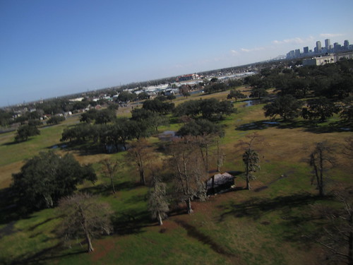
My attempt and results
I flew the little bear kite on 100lb test in high, gusty wind over the soccer field.
I used the RC picavet to direct a Canon 1400 camera rigged with a knot and tape to capture images and direct the obliques.
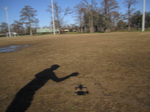
I am a bit proud of flying a shaky, unstable kite in high wind in my right hand while directing the RC unit on my knee with a left hand. not for beginners.

I flew on 11th january, in high and gusty winds.
The wind chart above, while from close by at the dog park, fails to indicate the true force of the wind, blowing strongly and erratically from the west, possibly amplified by a wind tunnel made along the nearby railroad track
The rain event from that morning is shown clearly.
Where the stormwater wetland worked
Imagery of the stormwater wetland shows that it is dry, and the cycle track nearby is also dry. However, the stormwater wetland is drained. The pond area, although planted with wetland plants, is being colonized by clover and other weedy species. This site may drain too well to ensure the dominance of wetland species as habitat, and benefits are not being maximized.

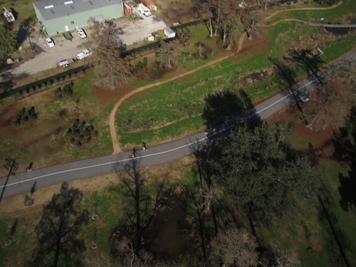
more images of the wetland built at the south drain show that this wetland is built to retain water even more effectively, slowing it down before it hits the drain. at this site, many wetland plants colonize the standing water, including many wetland trees.

In this image, much water is seen pooling in an area planted with wetland plants. Bald cypress trees are the bare trees.
Where the stormwater wetland is needed
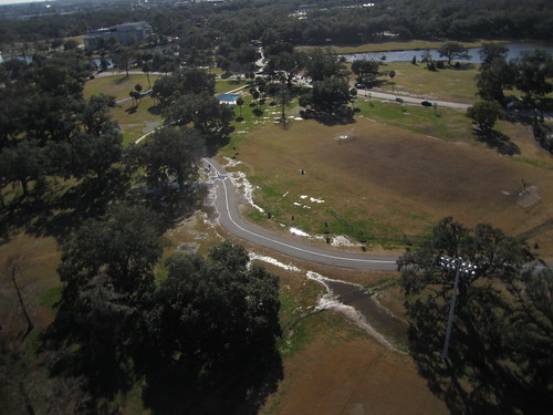
the west arm of the cycle track is flooded on either side of the track. This is likely due to recent grounds improvements for voodoo fest and jazz fest. The site of these "festival grounds" is used as a soccer field during the off season. Fill material was placed in these areas, pushing more water into adjacent areas.
Wetlands could be added to the line of oak trees at 29°59'26.21"N, 90° 5'30.43"W
as well as other locations, to draw water away from constructed features that are desired to be dry (and that could be damaged from regular expansion and contraction of water), while retaining that water in the ground overall.
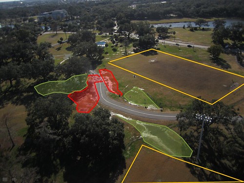
orange areas= new festival grounds /soccer fields, filled, graded, displace the normal groundwater storage.
red areas= areas where water is pooling where users wouldn't want it to be pooling
green areas= ares where water is pooling where pooling might be acceptable; these sites could be enhanced into wetlands to increase water retention, hopefully to drain water away from red sites while keeping water on the site in general.
Questions and next steps
The mapknitter is begun: https://mapknitter.org/map/view/city-park-stormwater-wetland
Carto Collective directory of images is shared: https://drive.google.com/folderview?id=0B32DNGN8pX_XWkk3dl9Ga3hFZW8&usp=sharing
flickr set is here: https://www.flickr.com/photos/eustatic/12462121753/
Why I'm interested
GRN's flood less campaign, there's a need to bring awareness to New Orleans' wet situation and the ability for alternative infrastructure to mitigate flooding.
Citizens can monitor their own environment with low cost tools, like kites, to obtain information that lead to improvements.
Scott Eustis, M.S. is a Public Lab organizer and GRN's Coastal Wetland Specialist.
4 Comments
I'm especially into your annotated oblique images, Scott. Really nice.
Reply to this comment...
Log in to comment
thanks, Mat, that means a lot. because i'm graphics-software-ignorant, it's just a screenshot of a powerpoint slide with the photo and drawings over it. the transparency option took me a minute to figure out, but powerpoint and Ms paint is there for us windows-addicted office drones.
Reply to this comment...
Log in to comment
This is great!
A surprising alternative/addition to what you did is to actually use Google Earth. They have a pretty accurate elevation function that you can use to draw directly on Google Earth where you find dips in elevation, and so where water would naturally migrate.
Reply to this comment...
Log in to comment
but for the fact that these features are not recorded in google earth yet for the most part...
Reply to this comment...
Log in to comment
Login to comment.