What I want to do
Continue to explore mapping with corrections to fisheye effect in images from low altitude UAVs (like this DJI Phantom flight). See prior note and note.
My attempt and results
Peter Swigert returned my helium tanks, kite gear, and cameras and demonstrated the DJI Phantom their team is using.
Peter is a graduate student at the UC Berkeley School of Information studying information management and systems. Their team is working on an initiative is to increase the ability of educators, community leaders and activists to gather and analyze imagery data about their community. They are focusing on the use case of helping people understand the effects of water use and drought in their community through imagery analysis, and are hoping to build off of the work that Public Lab has already done with tools like Mapknitter and Infragram.
This short video shows the set up, flight, and stowing of the DJI and Peter discusses its use in the context of their project.
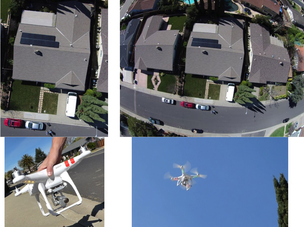
Peter shared a few images from the quick flight and I used Gimp to apply lens correction distortion to correct for fisheye effect from the DJI Phantom Vision FC200 on-board camera and cropped to a an interior selection with minimal distortion.

I made this single image map from the highest altitude image from the flight of DJI quad. I'm having a few issues with MapKnitter 2, that I've noted in GitHub.

Questions and next steps
Continue to explore situations where this combination of gear makes sense.
Why I'm interested
The increasing availability of inexpensive UAVs, like the DJI Phantom, together with ability to correct fisheye effect, makes for another aerial mapping tool in the toolbox.
3 Comments
Excellent post, Pat! It's been great talking to you about different technologies and approaches for mapping. Glad we had a chance to fly the Phantom.
Reply to this comment...
Log in to comment
Nice work Pat. Is there a way to learn more about the initiative mentioned and Peter's work?
For a deeper dive into fisheye, here's a pdf link to work by Alex Gurtner on the subject.
Is this a question? Click here to post it to the Questions page.
Reply to this comment...
Log in to comment
Hi Gerald. I'd be happy to chat with you about the project. Shoot me a note at peter.swigert@berkeley.edu!
Reply to this comment...
Log in to comment
Login to comment.