Mikey O'Connor's blog, Frac Sand Frisbee does an excellent job of explaining the problems with frac sand mines in Buffalo County, Wisconsin, and with providing resources to others to replicate a campaign against the mines. I highly recommend it. Images here are used with permission from Mikey.
Buffalo County has largely stopped frac sand mining in its tracks, based on strategies of attacking the long-term financial viability of mining, the impact on roads, the problems of increased truck transport, and most importantly, preservation of the scenic and rural character of the county.
I was drawn to the maps that Mikey makes to illustrate transportation problems and land use discrepancies in mine applications. I'm also fond of collecting mapping resources from non-GIS professionals to assist in designing the new annotations system for Mapknitter.
When asked about the maps, Mikey said that they have been the second most effective thing he's put together. (The first is below)
Two techniques stand out: First, the use of overlays, being able to drop one map on top of the other to show the differences. Mikey said that this is kind of a pain in Powerpoint:

here is a traced overlay to simplify and drive home a point about the discrepancy in land use plans:

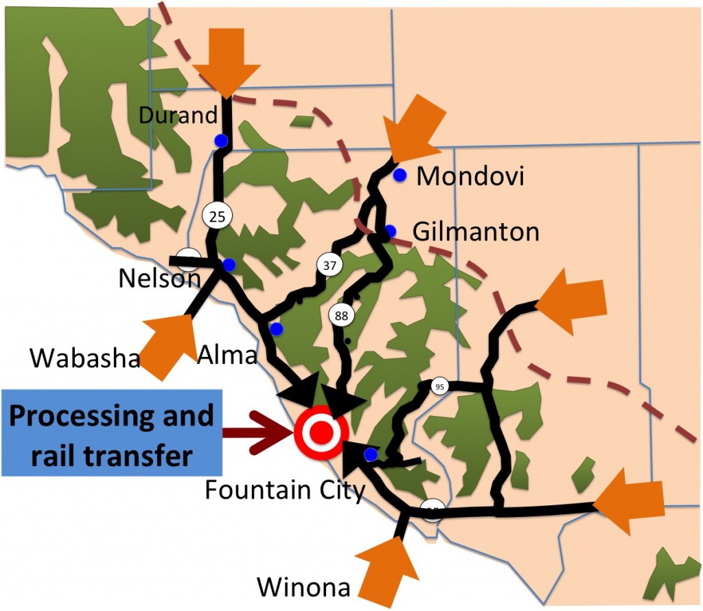
Second, using clear and simple symbols on an uncluttered map. These arrows and target to talk about the distances trucks will travel to transhipment facilities:

The Most Powerful strategy: Pictures
The First most powerful thing Mikey presented was a photograph and comparison of the Segerstrom Mine with other proposed sites:

"Just walk that photo around a hearing and everyone hushes up and the mine guys look at their feet," Mikey said. The hillside is too steep to be reclaimed after mining. Such is the power of images.
0 Comments
Login to comment.