A version of this story is published in Public Lab's Community Science Forum, Issue 17. Read more from this issue here.
At Public Lab, we often start a project off by working with a community to make a map. Mapping as a community is a great way to pool our knowledge and work towards a shared understanding of a place. There are many ways to make maps, but Public Lab often starts with a map made from aerial photos — taken from a kite or a balloon.
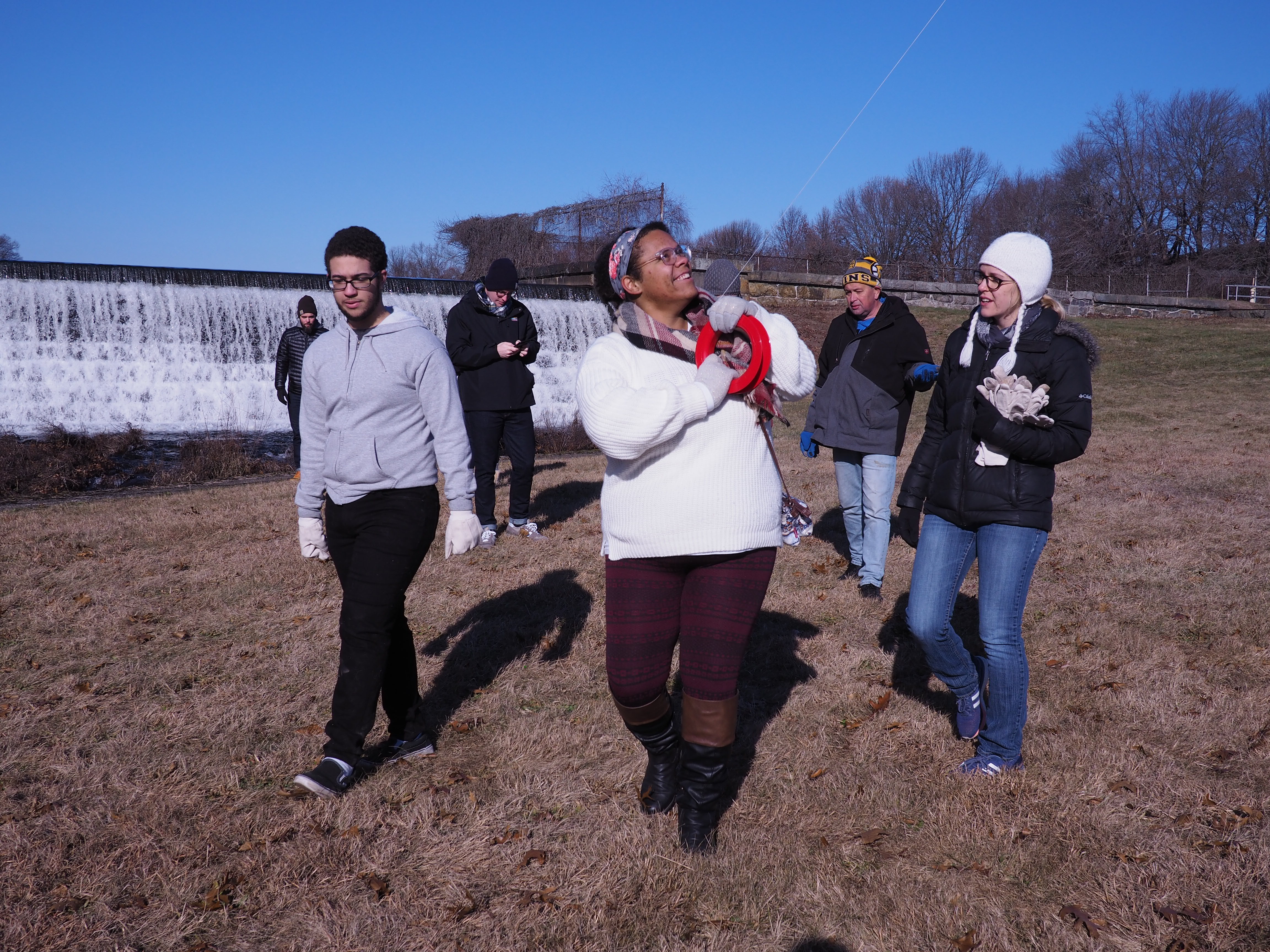
In the fall of 2018, I worked with Ayana Creighton and others of the One Cranston project in Cranston, Rhode Island, to organize and lead a kite mapping project. In early January 2019, we met with a group of kids from Bain Middle School on a bitterly cold afternoon, and we launched some kites!
What’s great about kite mapping — that is, sending a camera up on a kite to take aerial photos — is that it’s such a social experience. Unlike piloting a drone, flying a kite (or launching a balloon) is a group activity, and one which really requires multiple people to work together, from the person handling the camera to the folks managing the string. This is especially true when pulling the kite down!
At the Cranston Print Works site, we started near the parking lots, and worked our way north to the reservoir, then down to the “back yard” just behind the mill buildings, crossing the canal near the dam. It was cold, but we had gloves, and moving around helped us all stay warm. It was a great opportunity for folks to get to know each other and to talk about the history of the site.
One of my favorite things about kite mapping is that you are connected directly to the kite, and to the camera, by a string; it makes you feel like you’re almost up there yourself, looking down at yourself. With our new cameras, you can actually do this literally as well: the camera makes a WiFi network and people can log in and stream video from it while it’s in the air. Seeing yourself from an aerial perspective is really unique, and is another way this type of photography is different from, say, satellite photos, which seem so anonymous and disembodied.
Once you get a ton of photos (the camera is snapping one every couple seconds), a good way to make a group activity is to share the photos among a large group (which can take some planning if it’s all just on one SD card) and team up to find the best photos. That means both the clearest, sharpest images, but also those covering a wide area of the site you want to map. In this case, as is typical, the photos near the edges of the site were a bit blurrier, but it was worth it to include them to get a really wide area mapped.
Using the free and open source MapKnitter.org website, we then uploaded the images one by one, fitting them together like a jigsaw puzzle, stretching them to match the default Google map layer for reference. This can take a while, but the results can be spectacular, and it’s great to see a different view than the one Google offers: one that highlights not only the current state of the place you’re mapping, but often a specific time of day, an ephemeral moment like a festival, or a disaster like a flooded street.
Jeffrey Yoo Warren is the creator of GrassrootsMapping.org and co-founder and Research Director for Public Lab. He lives and works in Providence, RI and has made balloon and kite maps with communities around the world.
1 Comments
@joyofsoy has marked @warren as a co-author.
Reply to this comment...
Log in to comment
Login to comment.