Photo credit: Bill Hughes
Documenting Surface Water Turbidity and TSS using Photographs
If you encounter a discolored stream, taking a photograph and calling the county Land Conservation Department can be your first step in advocacy. Enforcement of permit compliance occurs where the problem originates (e.g. the discharge point, not the downstream affected area), so the best people to contact are the Land Conservation Department personnel in the county where the polluting site (e.g. mine or farm) is located. A great list of Land Conservation Departments in Wisconsin counties can be found here: http://wisconsinlandwater.org/about/county-land-conservation, where you can scroll to the “Quick Find” and type in the appropriate county or click “Show All”.
In Wisconsin, it is easier for county officials to respond to mining violations than to agricultural or non-point source pollution exceedences because the funding for enforcement comes from the mining permits. To enforce agricultural and non-point source pollution enforcement, the state/counties are required to provide 70% of the cost of enforcement activity (e.g. building a fence or proper drainage), and since these departments are chronically underfunded, the financial burden becomes a significant obstacle to enforcement. Since counties do not have a cost-share burden with mining permit enforcement, county Land Conservation departments are more apt to respond to mining-related violations.
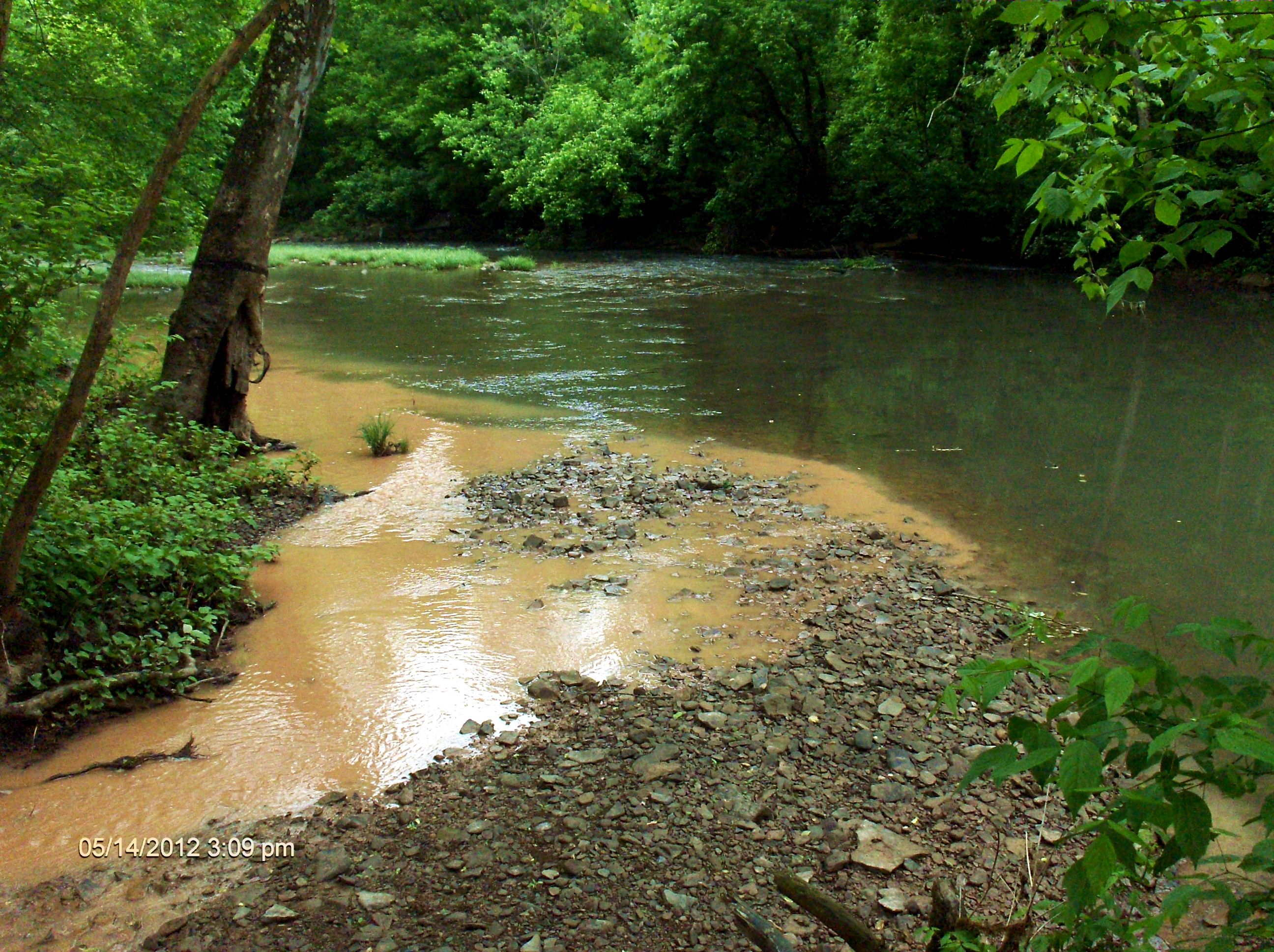
The most useful photos are ones that clearly document the time, location, and source of the pollution. Please be safety conscious and do not trespass on private property. For more information, please refer to the Photographer’s Bill of Rights. Please try to include these elements of good, actionable documentation of surface water turbidity in your photographs:
- Date and time-stamps
- Identifiable landmark
- Views documenting upstream and downstream of the source of turbid waters
- Views documenting any confluences, showing the turbid water stream and a non-turbid stream
- If there is more than one potential upstream source (e.g. farm and mine), a photo of the stream(s) passing through each land
Please include the following information:
Date and time: _____________________

GPS Location or Driving Directions: _____________________________________________________________________________

Photographers contact information (you may remain anonymous): ___________________________________________________

Responsible Party: ____________________________________________

Brief Description: ____________________________________________
Here are some examples of good photos:
2 Comments
Please post pictures in the comment section that are good example photos. I intend to put this information into a wiki page soon, and would love to aggregate some photos.
Reply to this comment...
Log in to comment
Hi, Gretchen - do you have some examples of when and where this technique has been successfully used by folks? Thanks!
Is this a question? Click here to post it to the Questions page.
Reply to this comment...
Log in to comment
Login to comment.