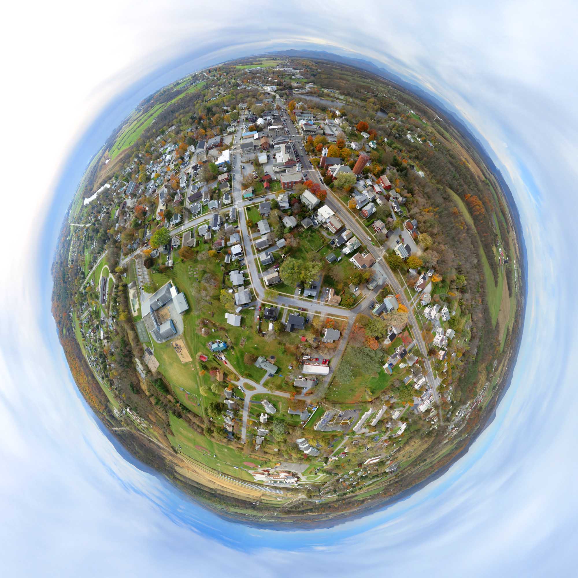
Above: Stereographic projection of a half-spherical panorama of Vergennes stitched from 23 photos taken by a Canon S100 on a Saturn V autoKAP rig lofted by a Levitation Delta kite on October 24, 2015.
After Friday's exciting flight in the hills, on Saturday I headed into the middle of the Champlain Valley, the flattest place in Vermont. I heard that a south wind was forecast to rise to 9 mph in the morning as clouds moved in. I arrived in the village of Vergennes just before the clouds arrived, but my shadow was mostly gone by the time the camera was flying. Had I heard the weather forecast with the wind advisory, I would have flown the Nighthawk Delta. But I didn't know 20 mph winds were expected so the Levitation Delta was launched. Either kite would have worked although the bigger winds that arrived after my flight might have overwhelmed the kite I was flying.

Above: After a few minutes I noticed the newly arrived cloud cover and pulled the rig down to change the ISO to 200 and the shutter speed to 1/640 second.

Above: The Saturn V Rig sporting the new double battery case holding six eneloop AAAs.
Cloudy bright conditions are good for aerial photography because information is not lost in the shadows and fewer highlights are blown out. As long as it is bright enough to allow fast shutter speed and low ISO, the result can be good. You can still see faint shadows in the panoramas here, so the lighting was just about right.

Detail of a fish eye projection of a larger panorama. You can find me in the corner of the school yard (lower left) but in the embedded panorama below I am considerably less blurry.
Above: Spherical projection of the same half-spherical panorama (stitched from 23 photos) use to make the little planet image above. This embedded image has all the resolution that was in the original photos and is a 160 megapixel image. Some of the sky is fake and was produced by MS ICE's "Auto complete" feature.
Sorry, no crashes today.
Flight notes:
Camera:
- Model: PowerShot S100
- ISO: 200
- Shutter speed: 1/640 second (Tv)
- Focus: manual on infinity
- Focal length: 24mm (eq.)
- White balance: Sunny (didn't think to change this)
- GPS: on
CHDK:
- Remote enabled: one push, quick
- The S100 has a shutter priority mode so CHDK is not needed for that
SkyShield:
- Version: 2.4 (3-switch DIP)
- Sketch: version 2.08sfm (beta)
- Mode: Mode 0 (for 24 mm lens, 25 photos/cycle)
- Power: 6 eneloop AAA
- Customization: The nadir tilt angle was changed from 20 to 11 so the camera was pointed straight down.
Flight:
- Kite: 9 foot Levitation Delta
- Wind: From S, 12 to 15 mph
- Duration: 70 minutes
- Photos taken: 1293
Panorama stitching:
- Software: Microsoft ICE
- Post processing: ICE's "auto complete" feature was used to create extra sky to fill in missing areas in the panoramas. Some stitching errors in the little planet panorama were hidden in Photoshop. Panoramas at Photosynth cannot be passed through Photoshop so what you see there is what Microsoft ICE produced.
0 Comments
Login to comment.