What I want to do
I want to continue to make potential users like Engineers Without Borders teams aware of the Public Lab DIY mapping tools.
My attempt and results
I did a workshop at Engineers Without Borders Regional Conference San Diego on 10/12/13. I've done this the last four years, on the Peninsula at YouTube's HQ, in Portland, at Cal Poly and this time in San Diego. I also presented a poster at EWB-USA International Conference.
Last year, Stewart Long and I talked about it and I incorporated his tips. He said the 1-hour session will go by in a flash. Get ready ahead of time. Get balloons or kites ready, rig attached, be ready to go. I did this again this year and it paid off. Everyone who wanted to fly the rig got a chance to do so and that was a hit. Also, fly first, get images; then come back and look at the vugraphs, and talk through the content. But it’s good to start making the map with Knitter, then after a few images are placed, export it. Show how it's done, end-to-end with real live data.
I set up projecting a slide saying, " We're outside flying, catch up with us. We’ll come back and try to make map. Look at the rest of the talk."
We did a sign-in sheet with a Safe Plan of Action (SPA). I asked all to think about what was the worst that could go wrong, what the hazards were, and how we'd address them. We added their concerns and had everyone sign in with their name and email address.
We flew the Balloon Mapping Kit balloon. It took most of a 110 scf tank of helium. We flew a dual-juice-bottle rig with Canon A490 infrablue with Rosco 2007 and SX260HS visible, both running CHDK intervalometer scripts. We captured over 180 infrablue images and 500 visible images.
We came into the classroom, went through the talk, opened Mapknitter placed an image and exported the map.
I’m working with Jeff Warren to put the images up on MapMill so we can collaboratively score them, then work together to put them in the map. Highlights follow:
Presentation: Simple Aerial Photomapping session, EWB Regional
Ground-based photos and examples of auto-stitched and 3D processed images from our session
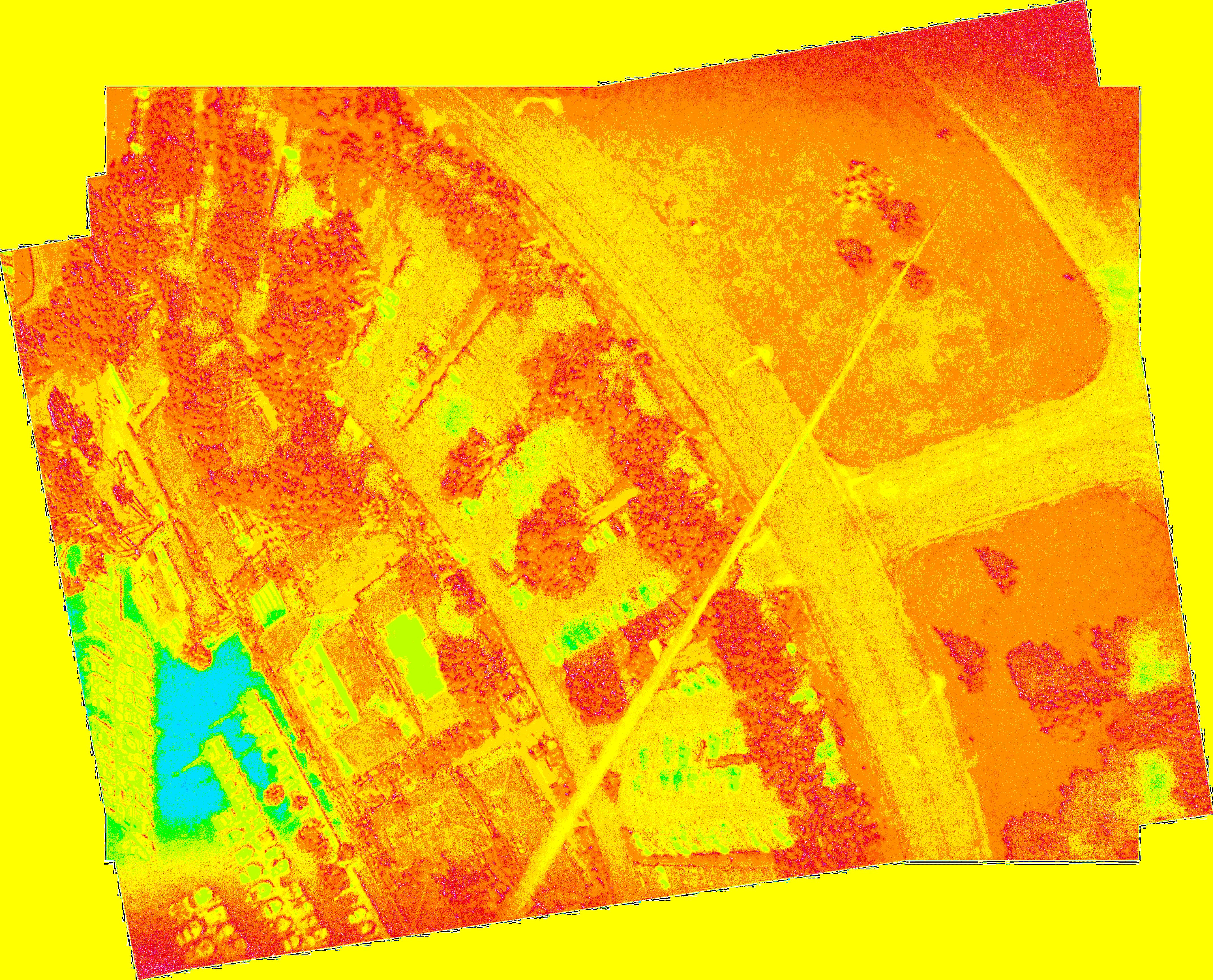
Microsoft ICE was used to stitch selected infrablue images which were then processed to NDVI with Ned Horning's ImageJ/Fiji macro. Autodesk’s web based 123D Catch was used to make a 3D model of selected infrablue images.
In-progress map of the individual NBVI images
Questions and next steps
Continue to explore where the Public Lab tools can be used by groups like Engineers Without Borders and communicate what's new in way of tools and techniques.
0 Comments
Login to comment.