What I want to do
Trying to find an affordable, reliable way for people to gather high-quality aerials with a UAV.
My attempt and results
UAV: A 3D Robotics Hexa-C (http://www.udrones.com/product_p/achrtf1.htm) It is very hard to fly. After much practice, with an RC controller, I can mostly keep it in position horizontally, by continuous rapid adjustments, but vertical control is loose and wind makes it even more difficult.
Camera: A long search and study of dpreview.com shows that, in fact, there are basically only 4 high-megapixel fixed-lens cameras which can take pictures continuously (commonly called time-lapse, or more obscurely as intervalometer):
Pentax Optio WG-2 (and WG-3), 16 MP, 192 g, $205 on amazon.
- Panasonic Lumix DMC-TS5, 16.1 MP, 214 g, $360 on amazon.
- Nikon Coolpix P510, 16 MP, (41.7× zoom!), 555 g, $370 on amazon.
- Ricoh GR, 16.2 megapixels, 245 g, $800 on amazon.
The first two are similar: cheap waterproof point-and-shoots. The Nikon is the heavy one with the crazy zoom (not useful IMHO for aerials) The Ricoh is the expensive one, with (one would assume) higher image quality for that price.
A link which compares the four: http://www.dpreview.com/products/compare/side-by-side?products=pentax_optiowg2&products=panasonic_dmcts5&products=nikon_cpp510&products=ricoh_gr&sortDir=ascending
I don't have any of those cameras, so my experiment today consisted of using my Android phone (Galaxy Nexus). I suspended my Nexus under my UAV by wrapping rubber bands tightly around the phone, then used cords through those bands to hang it under the UAV.
Software. On the UAV: Ardupilot. On the phone, an app is needed to tell the camera to capture full-resolution images, continuously (every few seconds). I tried several "time lapse" apps, all of which were deficient (resolution limited, or unstable). The one which worked (free app) was "Tina Time-lapse" (https://play.google.com/store/apps/details?id=com.tina.time_lapse&hl=en)
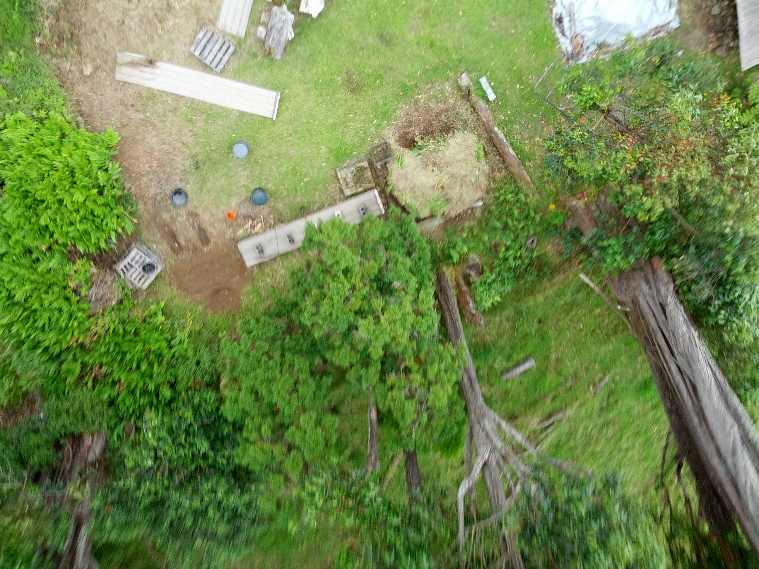
Test location: I flew on my farm in rural Hawaii (https://maps.google.com/?ll=20.05336,-155.509016&spn=0.000862,0.000932&t=h&z=20) You can see in Google's image (the best available imagery) many issues with graininess, poor color depth, canopy coverage including tree parallax lean, and shadows: Hence, the need to gather our own aerials there.
Test conditions: Overcast day, gusty winds from the northeast (tradewinds, almost always blowing).
Test operation: I set the UAV on a flat, open grassy area. I carefully reached the phone under the UAV to start the "Tina Time-lapse" app capturnig images. I set the UAV to "stabilize" mode, and took it up 10 feet. I then switched to "loiter" mode which, in theory, should make the UAV hold its position and elevation, but in practice, it does not; it is simply a little more stable than "stabilize" but still requires continuous correction. In "loiter", I took the UAV up to (guessing) 80-100 feet above ground, tried to keep it stable for a very scary minute, then brought it down, dodging trees, powerline, and ground obstacles to land it safely on the grass.
Results:
- The overcast sky made the images somewhat unsaturated.
- The wind made piloting difficult and frightening ($800 UAV could easily drift into a tree collision)
- The wind and rocky UAV flight made the camera focus poor and motion blur bad.
- Even if conditions had been perfect, resolution is limited by the phone camera (5MP nominal but lower effective detail). A few of the resulting images are online at https://plus.google.com/u/0/photos/100275646589690012041/albums/5886880918564651393
Questions and next steps
Things to try: 1. Try again with better conditions. 2. Buy a Pentax camera which has time lapse as a standard feature. 3. Try to get the UAV to pilot itself. I took it as high as I dared today. It's manual piloting, so I need to see the UAV well to keep it from drifting, which limits how far up. If i ever get the thing to actually fly itself stably, then I could let it go higher on an auto-path.
5 Comments
Hi there,
Great article. Love the experiment.
At first glance, I think a 3-axis gimbal would help you get a lot more stable shots.
Also, unfortunately, the uDrones site got taken down, so that link doesn't work anymore. We actually have a drone buying guide with a few great drones for aerial photos/video. Here's the link if anyone would like to check it out: http://uavcoach.com/buy-a-drone/
Reply to this comment...
Log in to comment
Nice experiment. It might be helpful to practice on a cheaper drone like these though before sending expensive equipment into the air.
Reply to this comment...
Log in to comment
@DroneBizMarketr presuming you aren't just spamming, can any of those sub-$100 produce GPS-tagged high-resolution aerial photos, suitable for uploading to e.g. dronedeploy.com? If so, please let us know. Otherwise, they are pretty much useless.
Is this a question? Click here to post it to the Questions page.
Reply to this comment...
Log in to comment
@bdiscoe No they'd only be useful for training purposes. But I wouldn't be surprised if we see that capability on drones around $200 by this time next year
Reply to this comment...
Log in to comment
Hmmm. its seems nice to try to you. I would also like to do the same. but everyone before doing this. check out this article: http://dronesdevil.com/drone-buying-guide-for-beginners/ which have a list of the most important features of drones which every standard one of them must have.
Reply to this comment...
Log in to comment
Login to comment.