Take 1
After a near windless summer I was really excited one day in late September that was particularily windy to finally get my kite and camera up and flying at Spanish Banks.
Short story is it was too windy and I lost my kite (string broke). I did get some rather interesting pictures though, but nothing useful for mapping.
Lessons learned:
- Use strong kite string on super windy days (I was using 50 lbs braided Dacron)
- Attaching a camera without a stabalizing housing thingy results in crazy but awesome looking images.

My kite was lost at sea, never to be seen again (despite my rescue attempts).

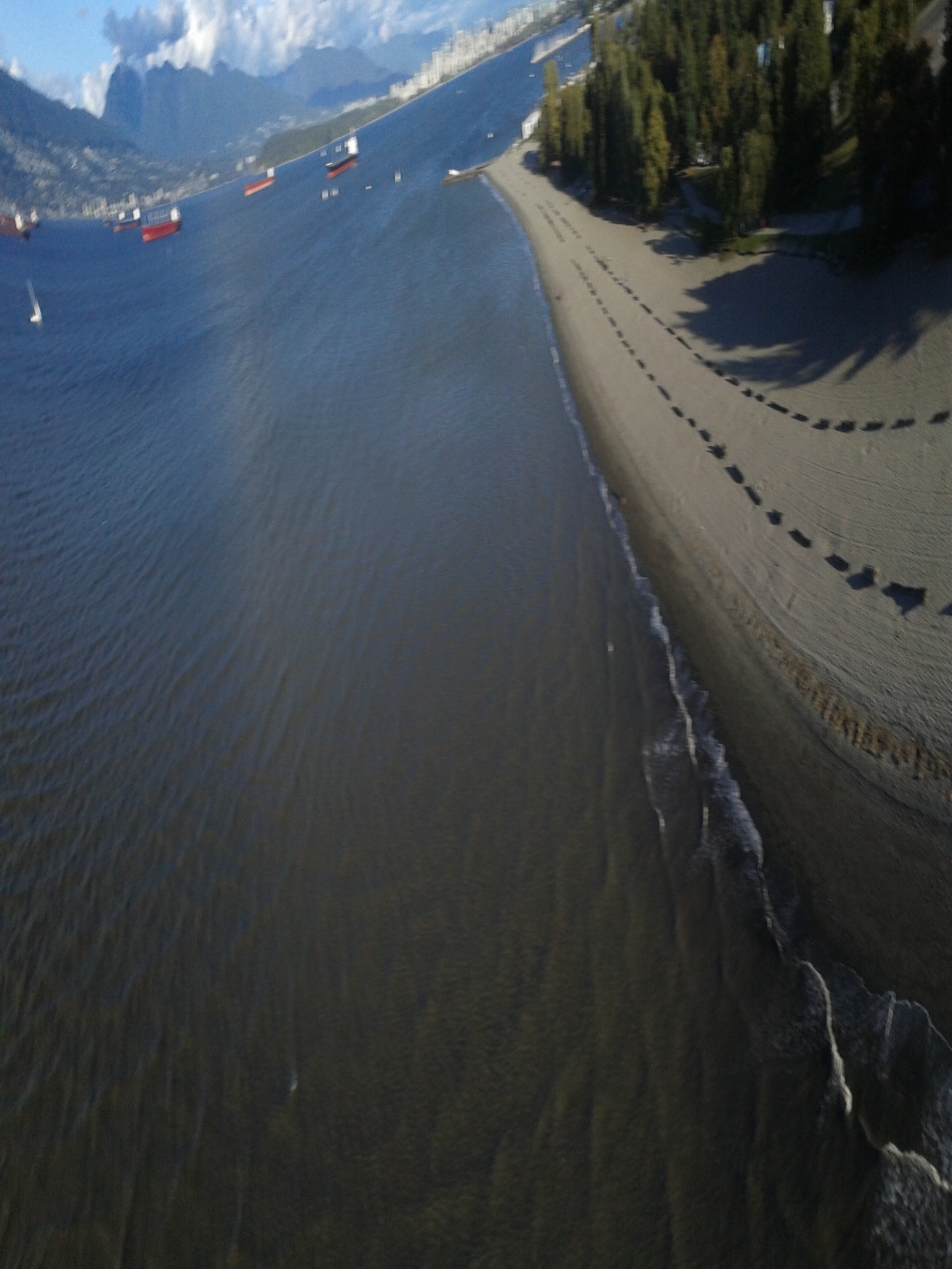
A wonderfully warped image of Spanish Banks with Downtown Vancouver in the background
Take 2
Yesterday, inspired after returning from the 2014 Barnraising, I decided to try my homemade kite that has yet to sucessfully fly (thanks to a no-wind summer). This time I opted to build my camera a houding made from some cardboard and a plastic plant pot.

The kite flew fantastically in (5-20 km/h wind), however the photo app, Tina Time Lapse glitched and didnt record anything.
Lessons learned:
- Persistence is necessary.
- Maybe I need to test out a new timelapse photo app.

Next Steps
- Make kite mapping more social and create a Vancouver Meetup
- Confirm kite flying heights since Spanish Banks is directly below the path landing jets are routed for YVR
- Troubleshoot camera glitches
Questions
- Has anyone else had problems with the Tina Timelapse app?
- Are there other Android apps that are better?
2 Comments
I haven't tried this, but a lot of work has been done on it by two Google Summer of Code students. http://publiclab.org/notes/mercyorangi/08-16-2014/sky-cam-user-guide
Reply to this comment...
Log in to comment
sorry to hear about that first kite loss!
Reply to this comment...
Log in to comment
Login to comment.