Gulf Coast
Welcome to The Public Lab Gulf Coast Page
We are: engaged citizens, researchers, educators, community organizers, hackers, more and all of the above! Since 2010 we’ve been working hard on spearheading many projects, developing DIY technology and spending time in the community working to celebrate our natural resources and the protection of them.
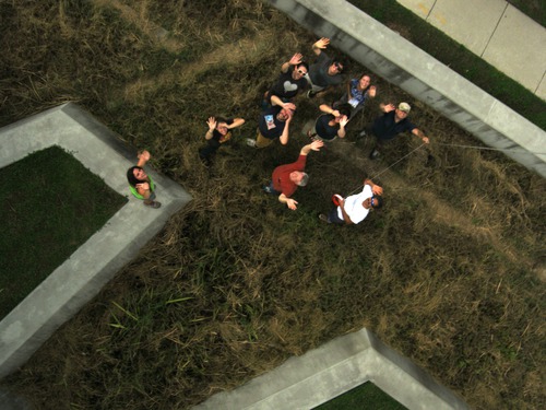
Some of our projects have included mapping of the BP Oil Spill in 2010, continued mapping and monitoring of the Barataria Bay focusing on the importance of our wetlands and restoration and working with other public labbers to develop the DIY spectrometer! For a better view of our projects and the people involved in them, see our timeline below, the research tab and search the tag gulf-coast on the Public Lab page.
Our office is located in New Orleans, LA at 4035 Washington Ave. Stop in and say hello!
Our Gulf Coast Organizers:
Scott Eustis
Dan Beavers
Hunter Daniels
Stevie Lewis
Shannon Dosemagen
Micheal Crumpler
Eric Kugler
Join
- You can join other Gulf Coast Public Labbers through our Gulf Coast Google Group,this is how we communicate local events and projects that you can get involved with.
Gulf Coast Google Group
- If you're interested in proposing a project, want to conduct your own mapping session or just want to hear about how you can get involved please contact us through the google group, and we'll help you get started (equipment, training, finding volunteers, etc.).
2015 Plans and Projects
Join us this year for the New Orleans Water Restoration Mapping Project.
We'll host a Mapping training February 21st! .
Spring Fling! Saturday, March 14th at Propeller 9-5pm
We're hosting Water Quality Meet Ups once a month Jan-June. Join our Gulf Coast Google Group for updates!
The Kickoff event launched us into the new year's exciting projects. Check out the post.
Check out our project Mapping Wetlands in New Orleans! This project brings together volunteers and local community members to discover and use Public Lab technologies to track the progress of eight urban wetland restoration projects near Lake Pontchartrain. Through training sessions and field work, Gulf Coast residents have the opportunity to learn and use the aerial photography tools to map and monitor the health of our local restoration sites. To get involved sign up for the Gulf Coast Goole Group. And follow the project on this page.
Past Projects
2014
Samples with Spectrometry! event brought about a lot of new thought on how the spectrometry kit could be used to test for oil.
Over 50 people joined us at our annual Barnraising at LUMCON!
The Urban Waters Mapping project has sprung a number of events and gatherings. Check them out! from Gerald and Scott
MapKnitter Club meetings! If you're interested in the technical side of making maps and want to get involved, please join the plots-gulfcoast@googlegroups.com to hear about ongoing mapknitting and plans.
Starting in 2014, Public Lab will be starting the new Homebrew Sensing Project.
We have completed the mapping project of the Barataria Bay. Stay tuned for the upcoming publication!
Public Lab participated in DredgeFest: Mapping five sites ahead of time and collaborating with the Dredge Research Collective to create annotated maps that were used in the main DredgeFest event in January 2014.
2013
Barnraising archived information on the Barnraising: http://publiclab.org/wiki/barnraising-2013.
Public Lab received a grant from Patagonia Clothing Company to do aerial mapping of twenty sites in Barataria Bay that grassroots mappers had previously worked at in 2011. The project is set to run between October 2013 and October 2014.
Public Lab has been working with a team at NASA DEVELOP, based at Stennis Space Station, using the DIY spectrometer to look at refinery flares. To view related research notes, search for the tag "flare".
2012
Mapping Bayou Bienvenue [background] [restoration] [greenslice]
Louisiana Nature Center Mapping
Big Branch map annotation
2011
We produced our second paper map (with the support of DevelopmentSeed) of Wilkinson Bay.
Worked to provide digital archives of collected images to libraries across the Gulf Coast.
Focused our mapping restoration and remediation efforts in the Louisiana wetlands.
Continued the mapping of the Barataria Bay region in partnership with the Louisiana Universities Marine Consortium.
Connected with researchers regarding data use and potential collaborations.
Worked to develop and test out new PLOTS tools- infrared and UV cameras.
Tested out a time lapse camera that will be mounted in a wetland area near Cocodrie, LA.
Tested the Hydrogen Sulfide sensor in development
Grassroots Mapping: Kickstarter Pitch from TungstenMonkey on Vimeo.
2010-2011 The Deepwater Horizon Oil Spill Mapping
Since May 2010, we have been using balloon mapping to capture aerial imagery of spill-affected sites in Louisiana, Mississippi, Alabama and Florida. Our work on the Gulf Coast in 2010, was done in cooperation with groups such as the Louisiana Bucket Brigade and the University of South Alabama on a community-led monitoring of the Deepwater Horizon oil spill. The data has been gathered can be viewed in:
the Public Laboratory Archive »
More images and information can be found at:
- https://www.flickr.com/photos/tags/gulfoilmap/
- http://unterbahn.com/thesis - Chapter 8: Case Study: Citizen mapping of the BP oil spill (5.7 mB, 14 pages)
- and in the various press and publications listed on our media page
While mapping the oil spill, we were not trying to duplicate the satellite or flyover imagery (though we helped to coordinate some of the flyovers and tried to ensure that the data was publicly accessible). Instead, we were helping Gulf Coast residents to use balloons, kites, and other simple and inexpensive tools to produce their own documentation of the disaster and hoping that such data collection will continue to support environmental research, policy, and regulatory changes in coming years.
How-to Mapping Guides
Look at our 4-page PDF guide to get started.
Equipment:
- Canon cameras or Android phones (see Balloon Mapping Materials)
- Weather balloons (5 feet diameter or more)
- string, lots of string
Mapping Resources
- NOAA's latest prediction maps -- PDFs available for 24, 48, and 72 hour horizons
- Latest MODIS imagery - often cloud-obscured
- etc. mapping resources-- pulled from posts to grassrootsmapping google group