On our weekly organizers call, we discussed software for doing 3D reconstructions from photos. I thought I'd make one list of the options currently available. Please add more in the comments if you know of any.
Free & Open Source Software
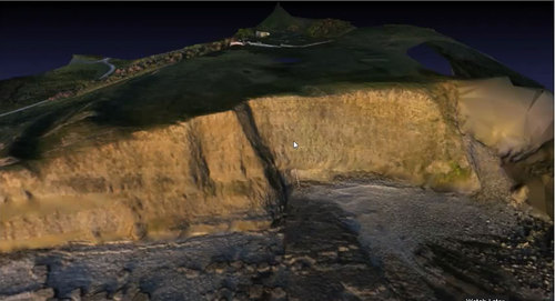
VisualSFM and geobduffy's tutorial on it
MicMac my previous note on MicMac MicMac's english documentation Mic Mac can supposedly do orthoimage creation too.
Python Photogrammetry Toolbox is available as a part of ArcheOS, a livedisk of linux with visualSFM & Python Photogrammetry toolkit installed. Here is a tutorial on its use
Free or limited Free use Commercial Software
Cubify (formerly Hyper3D)
6 Comments
Hi Matthew, It's good to see this interest in PLOTS. A couple other open source (or nearly so) packages related to 3D mapping are: SURE (compatible with VisualSFM output): http://www.ifp.uni-stuttgart.de/publications/software/sure/index.en.html
Ecosynther: described here with links: http://ecosynth.org/profiles/blogs/ecosynther-v0-7
There was a nice overview of several (mostly proprietary) packages in this paper: http://www.ifp.uni-stuttgart.de/publications/phowo13/240Haala-new.pdf and a presentation here: http://www.ifp.uni-stuttgart.de/phowo/2013/presentations/240Haala.pdf
Reply to this comment...
Log in to comment
Thanks, Ned. Can't believe I forgot Ecosynther! that's one of the cooler ones.
That presentation is excellent in comparing the advantages of different solutions. Here were the software packages they looked at:
SocetSet, BAE Systems. UltraMap V 3.1, Microsoft. Match-T DSM 5.5, Trimbly/inpho. ImageStation, ISAE-Ext. GeoSystems. Astrium, PixelFactory. RMA DSM Tool, Royal Military Academy. Joanneum Research, Graz. MicMac, IGN France. SURE, Stuttgart University. DLR-SGM, German Aerospace Center.
Reply to this comment...
Log in to comment
It might be good to also note which if any of these programs will make orthophotos -- just autostitch air photos into map images without topographical information. I suspect some of them must because it has to be easier than sfm.
Reply to this comment...
Log in to comment
Chris, I pointed out that MicMac seems to be the only OS software with built-in orthorectification functionality, but there are some other options too:
There is a post on the ATOR blog (developers of python photogrammetry toolbox) on using GRASS to georectify point clouds. It LOOKS easy.
There is also a DIY Drones thread on this topic, and they mention the ATOR blog's PPT/GRASS workflow and MicMac as well. And also the free trial version of Pix4D Mapper
Is this a question? Click here to post it to the Questions page.
Reply to this comment...
Log in to comment
Also- Open Drone map
Reply to this comment...
Log in to comment
Also Autodesk Recap 360 and ReMake
Reply to this comment...
Log in to comment
Login to comment.