From Richard Campanella:
Why I'm interested
Stories of their failures:
"Photographing New Orleans, however, proved frustrating, indeed nearly disastrous. The first attempt, in 1920, was thwarted by unsuitable weather: the mission required that all skies over the city be clear below an 8,000-foot ceiling, literally a tall order for this region. The second mission, in 1921, never quite photographed the city because it first flew down to map the mouth of the Mississippi River — only to run out of gas, forcing the pilot to land in the Gulf of Mexico. He and the photographer were finally found, alive but suffering from exposure, two days later. The third mission completely failed to get off the ground, as a storm in Lake Pontchartrain tore the seaplane “from its moorings off the Southern Yacht Club [and] ground [it] to bits against the sea wall.”
Successes:
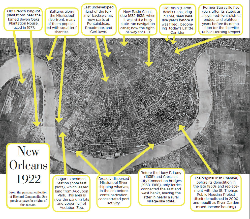
The fourth attempt proved the charm, and in 1922, under perfect weather conditions, one Ensign Keene piloted a plane that, with the help of chief photographer Daniel W. Culp and a flight crew, had been rigged with “an automatic camera operated by a wind motor from the streamline of the propeller, at the rate of one every third-five seconds, with a 50 percent overlap in each [frame]. These photographs measure 7 by 9 inches.” It appears that the film was developed at the Pensacola naval base and mosaicked — that is, strategically subsetted within the overlap regions and pasted together like a puzzle — to form a first-ever photographic map of the City of New Orleans.
The First "Passenger Pigeon" effort
During the heyday of aviation experimentation in the 1910s, individuals lugged cameras aboard aircraft and snapped photographs of the cityscape on either side of the cockpit. Local archives retain a handful of these magnificent “oblique” views of New Orleans, including a particularly valuable one of Storyville taken around 1914.

1 Comments
overlay with the historic image using MapKnitter: https://mapknitter.org/map/view/1922-new-orleans
Reply to this comment...
Log in to comment
Login to comment.