What I want to do
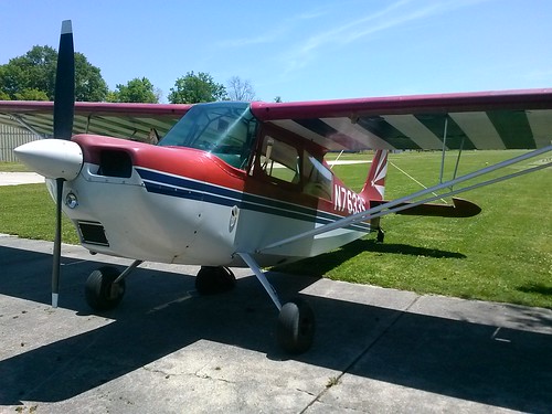
As Part of the Barataria mapping trips, and in collaboration with the Gulf Montioring Consortium, Southwings recruited volunteer pilot Lance Ryberg to fly his acrobatic plane with Scott Eustis of GRN, public lab organizer.
This plane could map 10 sites quickly, using a Canon 7D camera with a polarized lenscap
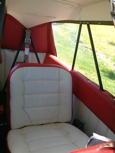
The well seat did provide a challenge to taking photos at nadir.
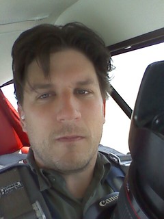
I promise it was more fun than I look!
My attempt and results
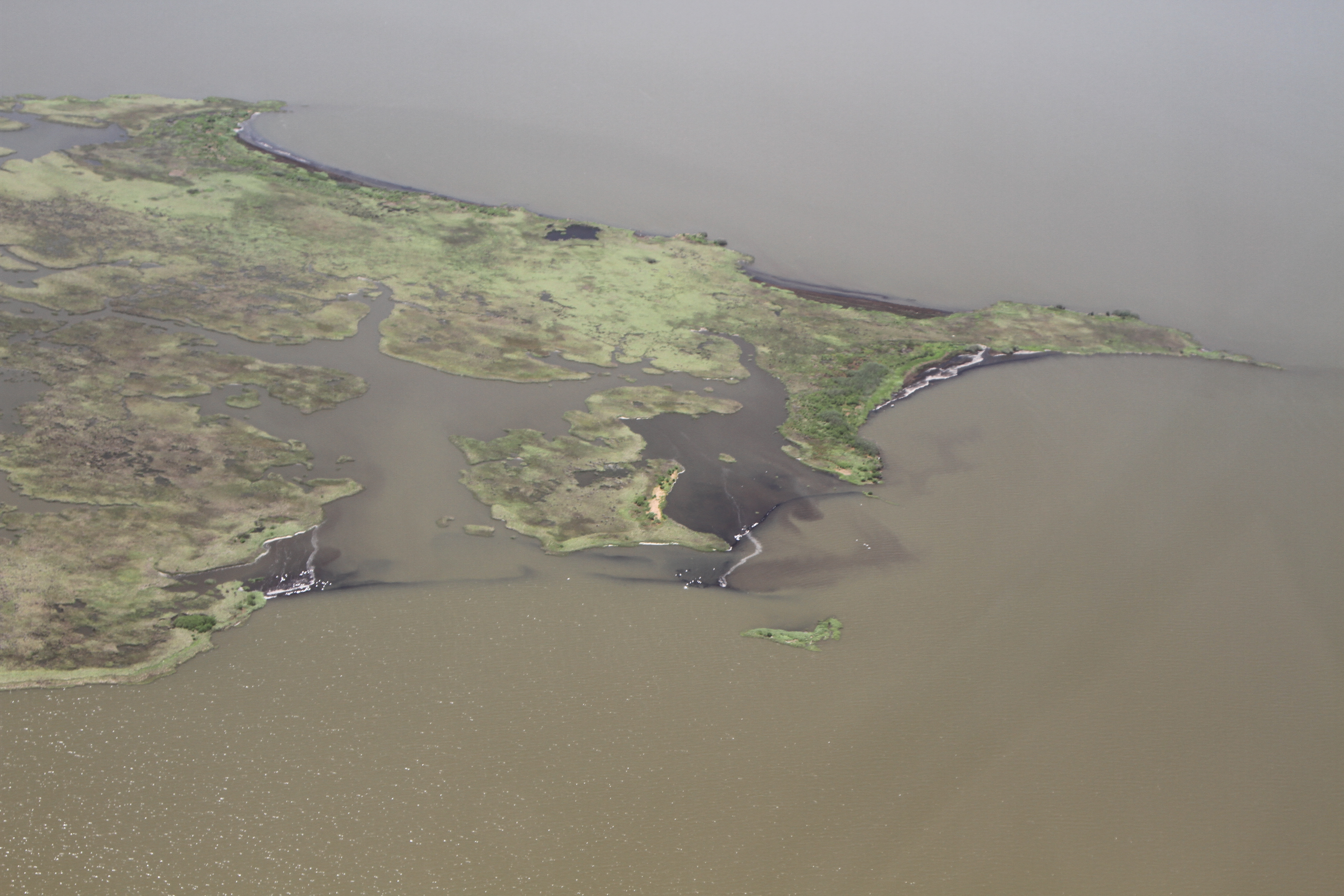
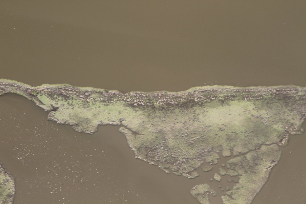
BM5 site

the flight collected over 3000 pictures, necessitating purchase of additional cloud storage for photos.
Lance was able to "skid" the plane, or bank while flying straight, in order to enable scott to take photos as close to nadir as possible. the camera was focused through the window, then transferred through of the window for the highest clarity of shots; so the clarity is limited on some photography to ~10cm data rather than ~1cm data.
The plane, while quite manuverable, seats the passenger low in the harness, so that it is very difficult to take downward facing photos while viewing the results from this airplane. Thus, many photos were taken by aiming from the backseat, then transferring the camera out of the window. Probably not the best method, but it worked.
Questions and next steps
Rattlesnake Bayou and Oilfield Sites (Barataria Bay Northeast)
aBN4
https://drive.google.com/folderview?id=0B32DNGN8pX_XODVRczltQS1JaUE&usp=sharing
https://mapknitter.org/maps/barataria-bn4 (wrong lat long in mapknitter?)
aBM5
https://drive.google.com/folderview?id=0B32DNGN8pX_XSWxUSUZHbWY2ekE&usp=sharing
https://mapknitter.org/maps/barataria-abm5 (wrong lat long in mapknitter?)
aBL4
https://drive.google.com/folderview?id=0B32DNGN8pX_XbGdiQ2tSdHJlRDA&usp=sharing
https://mapknitter.org/maps/barataria-abl4
aBN5
https://drive.google.com/folderview?id=0B32DNGN8pX_XVlJMUk9wdmZTSHM&usp=sharing
https://mapknitter.org/maps/barataria-abn5
Bay Batiste Sites
aBM4
https://drive.google.com/folderview?id=0B32DNGN8pX_XeDIzUjNiMnJ0c28&usp=sharing
https://mapknitter.org/maps/barataria-abm4
aBH5
https://drive.google.com/?authuser=1#folders/0B32DNGN8pX_XNHRPXzMtMEhyTGM
https://mapknitter.org/maps/barataria-abh5
Bay Jimmy Sites
aBH2
https://drive.google.com/?authuser=1#folders/0B32DNGN8pX_XZE9weVdicFVQSm8
https://mapknitter.org/maps/barataria-abh2
aBH3
https://drive.google.com/?authuser=1#folders/0B32DNGN8pX_XZE9weVdicFVQSm8
https://mapknitter.org/maps/barataria-abh3
aBL3
https://drive.google.com/?authuser=1#folders/0B32DNGN8pX_XQ19oS1NqSmx2bm8
https://mapknitter.org/maps/barataria-abh1
Why I'm interested
Barataria Bay is growing rapidly, and the rim marshes are losing land rapidly. BP's oiling is accerating the erosional process in this area. This photographic effort and mapping allows us to show that in great detail to a mass audience, and hold BP accountable for its damages, despite its massive Public Relations Campaign and close ties to the US government.
These sites are also planned for restoration, so documenting their loss is critical for efficient expenditure of public monies in the future.
0 Comments
Login to comment.