Long Beach, Mississippi
Mapped by Jeffrey Warren, Kris Ansin, Jocelyn, Lauren Craig, Jocelyn Piccin
Cartographer: Jeffrey Warren
Published by warren
29.5178461626856 N, -89.12338286283929 E
116 views
Capture date: 2010-05-20T00:00:00
Publication date:
License: Public Domain
Mapped by Jeffrey Warren, Kris Ansin, Jocelyn, Lauren Craig, Jocelyn Piccin
Cartographer: Jeffrey Warren
Published by warren
29.5178461626856 N, -89.12338286283929 E
87 views
Capture date: 2010-05-20T00:00:00
Publication date:
License: Public Domain
Notes
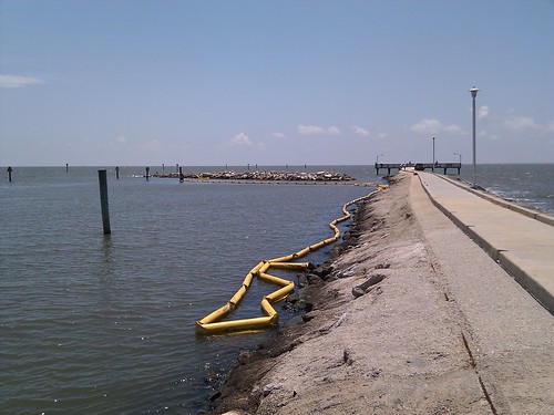
Flew at 10am-3pm, ate at Waffle House; about 1000' high with a Sutton Flowform 16 kite. Good steady wind, grew until it started getting a bit much... ended at about 20mph or more, starting to have trouble holding onto the reel. 200 images.
We spoke with a fisherman on the pier, who pointed out that dead fish were washing up more than normal. He was fishing for fun and said he definitely wasn't going to be eating anything. We saw some dead sharks in the rocks, but it could've been from fishermen gutting them. Several large dead fish as well though.
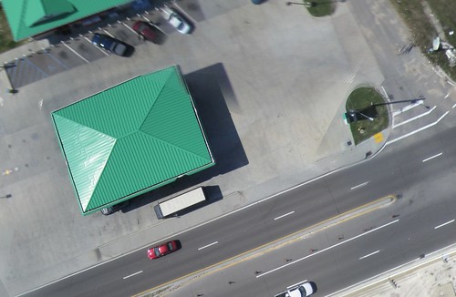
BP gas station:
Sunbathers:

Notes
Flew at 10am-3pm, ate at Waffle House; about 1000' high with a Sutton Flowform 16 kite. Good steady wind, grew until it started getting a bit much... ended at about 20mph or more, starting to have trouble holding onto the reel. 200 images.
We spoke with a fisherman on the pier, who pointed out that dead fish were washing up more than normal. He was fishing for fun and said he definitely wasn't going to be eating anything. We saw some dead sharks in the rocks, but it could've been from fishermen gutting them. Several large dead fish as well though.
BP gas station:
Sunbathers:
Cartographer notes
0 Comments
Login to comment.