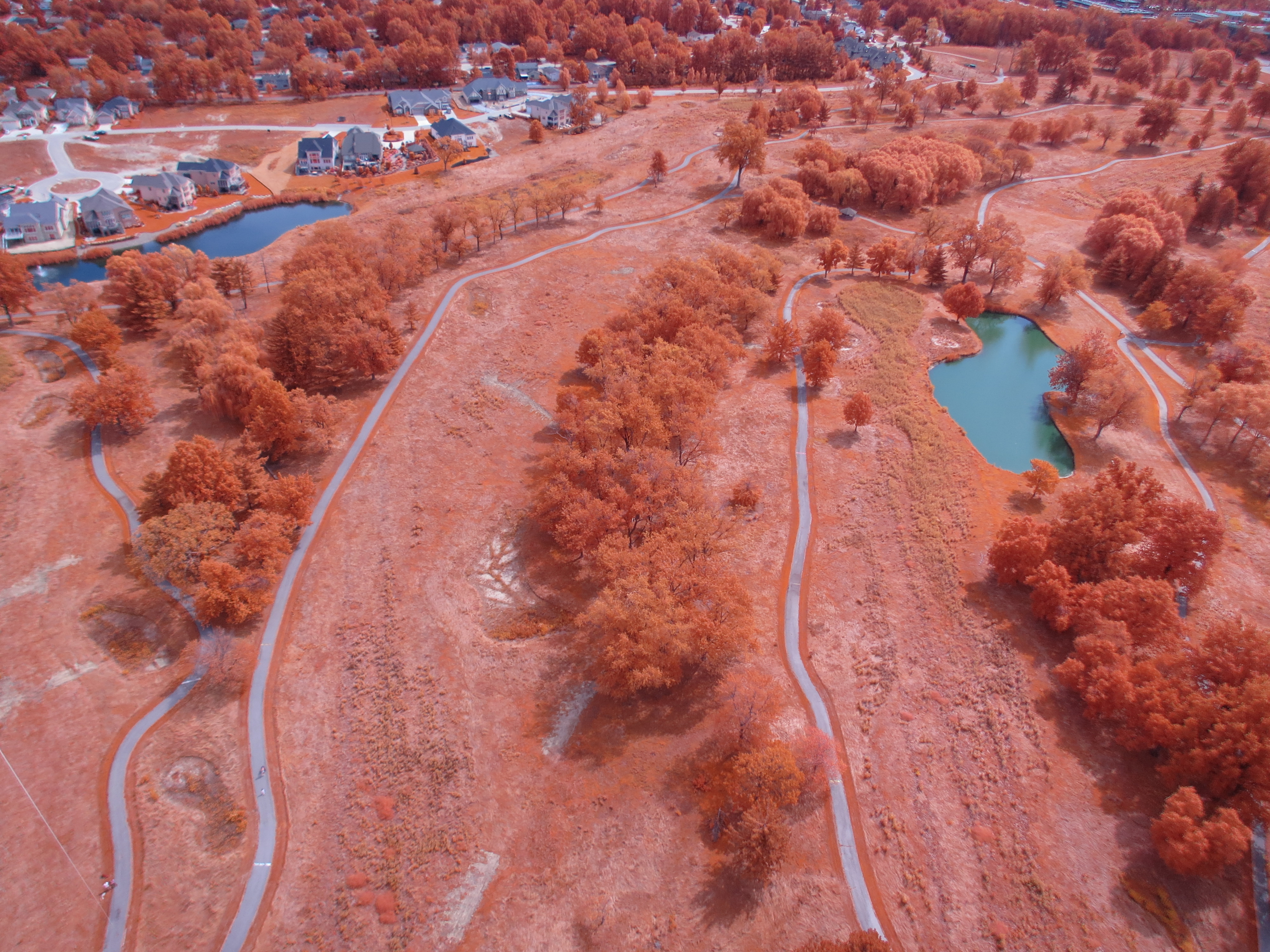
Last week the whole office spent some time flying the helikite at Acacia. We totaled 4 flights and about 20 usable sequences. This time we took some IR photos to get an assessment of the vegetation. The weather was very good for helikite flying: low cloud cover and low wind. Here are some photosynths from a few of the flights:
For day 2, I adjusted the title angles in the SkySweep code, to get less sky in the pictures:
int tiltAngle5[]= {100, 80, 60, 40, 20};
int tiltAngle4[]= {100, 86, 53, 20};
int tiltAngle3[]= {100, 70, 40};
This time there were no problems with the Saturn V, but for some reason the GPS logging was disabled on CHDK all the SD cards, so there is no GPS ephemeris in the EXIF for the first 3 flights. That's not a problem for creating panos, but makles it impossible for getting georeferenced orthophotos in OpenDroneMap. Flight 4 (Acacia North) did have georeferenced photos, so I was able to create this point cloud:

As you can see, there are some issues of completeness in the point cloud, some I can hypothesize the reason:
The perimeter region is far from complete. This is very likely due to lack of overlap in the more horizontal tilts. This is easily remedied by adding more angles.
The area behind vertical structures (facing away from the camera) are missing points. I'm not certain about this one. Maybe we need to simply go up higher. We should be marking the towline at regular intervals.
The center. I honestly have no clue about this one. There are over a dozen photos containing that area in the 130 photo dataset.
I think it's hard to say how useful ODM will be for spherical photo datasets. Next I will test some adjustments to SkySweep to increase overlap and try walking the kite along a trail in an open area.
5 Comments
Cool! which size helikite do you have?
Is this a question? Click here to post it to the Questions page.
Reply to this comment...
Log in to comment
3.3 Cu m
Reply to this comment...
Log in to comment
It's great to see that you have the Saturn V Rig performing well enough to produce all these excellent 360° panoramas. That's quite an artistic point cloud you created. I'm guessing that since all of those photos were from the same flight, they were all taken from about the same location. Your plan of walking the helikite around to get coverage from lots of viewpoints sounds important. If you are using the original sketch that takes the same number of shots at each tilt angle, you should be getting lots of overlap among the photos from the lower tilt angles. And also lots of nadir photos. The hole in the middle of your point cloud must be at the nadir, so that's a mystery.
I wonder if the higher tilt angles contribute much to sfm reconstructions. They provide a different angle but the subject is far away and therefore lower resolution. Maybe the ideal mode for sfm would be just two or three tilt angles from about 40° to the nadir so the horizon is never close to being included in any photos. There is probably no reason to take more than a few nadir photos in each cycle. I guess the more the rig moves around the landscape the better.
It's a lot of work to figure out the best way to capture the photos. Thanks for investing all this effort.
Chris
Reply to this comment...
Log in to comment
hey, d
great work here
I noticed that your mapknitter of this project was stalling https://mapknitter.org/exports
maybe because you've got 131 pictures loaded? Mapknitter export hasn't worked for me in a while, so i'm just asking people with stalled projects to re-start or re-evaluate.
Cheers!
S
Is this a question? Click here to post it to the Questions page.
Reply to this comment...
Log in to comment
@eustatic thanks for the notice. I deleted the whole map, I'll try to come back to it when I have more time.
Reply to this comment...
Log in to comment
Login to comment.