By Cartographer: Scott Eustis | Mapper: Scott Eustis
201 views
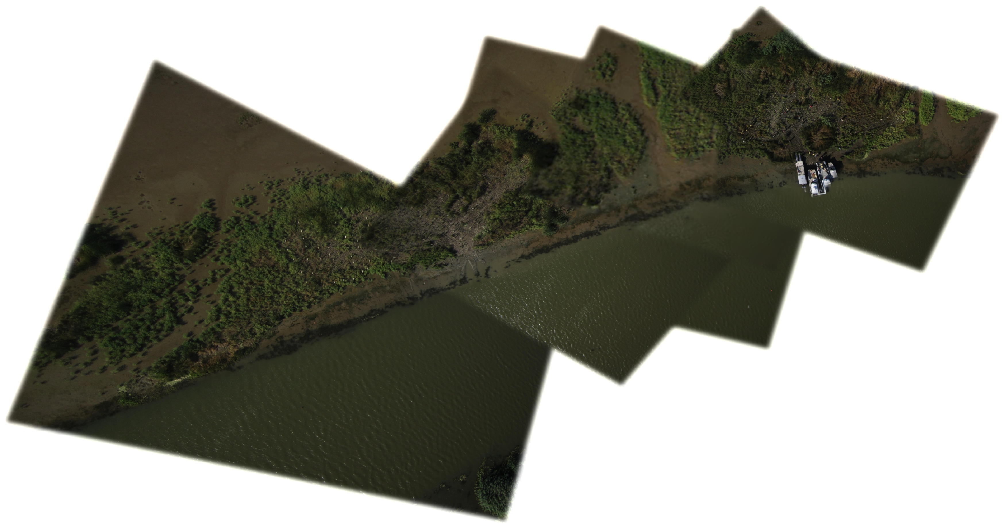
Ground resolution: 9.21 cm/px
Capture date: 2013-11-09
Publication date: 2014-01-24
License: Public Domain
By Cartographer: Scott Eustis | Mapper: Scott Eustis
166 views
Ground resolution: 9.21 cm/px
Capture date: 2013-11-09
Publication date: 2014-01-24
License: Public Domain
Kite: Little Bear Rig: RC Picavet Camera: Canon 1400 with trigger taped down wind varied from 10-15 mph, but at a certain elevation, the kite would not climb.
link to photo selection. http://www.flickr.com/photos/eustatic/tags/restoretheearth/
Gulf Restoration Network and Public Lab. This work may appear at DredgeFest Louisiana Jan 17 and on Google Earth in the coming months.
All told, the site was 600m long, but I don't know if the site was planted as planned. So it may be much shorter.
i'm unsure about my coverage of the western edge of the site, since the boat left with my kite before i could map it and i ran out of time...but i have about 1000 more photos to go through, i know i got at least a partial rendering. I do think that the site is not as extensive as the plan states. I know that the 5 gal cypress were planted more in the "back," because I was in charge of that planting team. I could probably annotate these particular 25 trees, since Royal team planted them with care.
Colored stakes used to guide the planting are indeed visible in the photos--there was a strip of the planting plan, that if retrieved could provide a reference. But I think i washed mine in the washer.
0 Comments
Login to comment.